- Boat
- Articles
- About
- Tehani-li Logs
- 2004
- Uligan Maldives
- Man, Oh Man, Oman
- Eritrea: The Nicest Place You’ve Never Heard Of
- Cruising Notes: Oman to Eritrea – From Pirates to Cappucinos
- Old Testament Sudan
- Egypt: Legend, Myth and Reality
- Thoughts on Cruising the Red Sea
- Greece: Civilization Again
- Montenegro
- Malta
- Sardinia, Italy
- Barcelona, Spain
- 2003
- 2002
- 2001
- 2004
- Contact
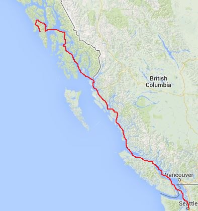
Seattle to Sitka
The previous post, “Sailing to Alaska” is an easy to read overview of our “big trip” over the summer. It was written for non-sailors, family and friends. I have expanded the detail of our Alaska trip in the following posts for cruisers who may be interested in seeing Alaska from their own boat. Naturally, this cruising area isn’t for everyone but for those who go to Alaska and who like wild, untouched natural beauty you, like us, will fall under her spell and a lot of good things will happen!
As always, all pictures here are taken by me. Those that aren’t have the url picture credit embedded in the image and by clicking on the picture a new page will open which will take you there. I find this less intrusive than putting a lengthy url under each picture or the words “image credit.”
Seattle to Sitka
Of the four seasons I have always looked forward most to the three golden months of summer. As a child it meant freedom from the rules and regulations of school. The freedom was temporary in nature but when you are ten years old however, three months is a long time. Now that I am older (and some might still say a child) I looked forward to this summer for the same reasons; freedom to go forth and explore.
We had three months exactly and a long way to go. Alaska was calling and I wanted to see as much of it as we could. This necessarily meant we had to skip or just fly through large swathes of territory that would otherwise be a destination itself. My thinking is since we are based in Seattle the closer the area to the city the lower the priority as we will be able to go back to those areas when we have shorter vacation times in which to do it.
There is also plenty of information and some very good guides out there on Southeast Alaska as the area is 1) close to major population centers, 2) easy to get to, 3) easy to cruise through and 4) beautiful. Nothing wrong with that list, for sure. Our focus, however, was to be on areas that were a bit harder to get to so I won’t concentrate on how we checked in to Canada or where we anchored in the Gulf Islands (boring!).
Originally, I had planned to go up to Alaska on “the outside,” or offshore as seasonal winds are supposed to be favorable in June. They are supposed to be southeasterlies and push you up. Of course, we had several weeks of northwesterlies so we decided in the final analysis it would be faster to motor up on “the inside.”
Everything changes once you pass through Dodd Narrows at the end of the Gulf Islands and just before Nanaimo. Timing the current correctly was important as the narrows are just that, narrow! They felt like they were only about two boat lengths wide but, depending on tide levels, are more like 250 feet wide at the narrowest point. Keep in mind traffic can be heavy at slack so you may only have 100 feet of width to play with and keep to your starboard side of the channel if so.
Heading north and coming out the other end the winds and water are immediately different. You have left the lazy hazy daze of “vacation land” and now are in “working BC.” The wind is colder and so is the water and the waves are higher too. Also, the logs are now much more frequent floating in the water and this will worsen all the way to Alaska.
We anchored that night in Tribune Bay, Hornby Island (N 49.31.263, W 124.37.608) which is wide open to the SE but flat calm if the wind isn’t blowing from that direction. The island was named for Captain Geoffrey Phipps Hornby of the 31-gun steam frigate, HMS Tribune, who was instrumental in preventing conflict between the United States and Canada during “the Pig War” of 1859. We dropped the hook in 39 feet over a mud and sand bottom. Even this shallow depth kept us well off the beach and it was a dead easy anchorage. This is one anchorage you could enter at night even without radar. We had a calm night and slept well after motoring for 12.6 hours and covering 76 miles from Bedwell Harbor where we left that morning.
Vile water
The next day we had to face Seymour Narrows. This treacherous stretch of seawater has been the last thing many unfortunate mariners have seen when they got the tides wrong. Countless ships came to grief with currents running up to 16 knots taking helpless craft to their doom on Ripple Rock which splits the channel in two like a sharp knife running through a ripe melon. Captain George Vancouver called it “One of the vilest stretches of water in the world.”
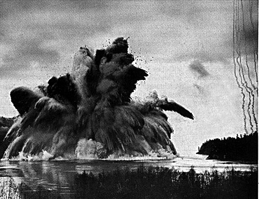
In 1958, after 27 months of drilling and engineering work, Ripple Rock was blown up with almost 1,400 tons of TNT making it the largest non-nuclear blast in the history of North America. You can watch the black and white video on YouTube.
Thankful for their dogged and determined efforts, we waited for slack water and passed through with no troubles. It was interesting to see our SOG leap from 2.7 knots to 8.5 knots in a matter of minutes. Our ride was flat calm and we averaged 6.7 knots over the ground.
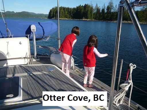
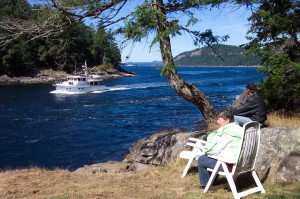
Travelling 66 miles that day, we anchored that evening in Otter Cove, off Vancouver Island in 40 feet (N 50.19.434, W 125.26.932). We were now north of 50 degrees for the first time. This is a good anchorage as it is right before the entrance to Chatham Point Lighthouse which marks the entrance to Johnstone Strait. All Canadian lighthouses are gorgeous, it seems; carefully painted white with bright red roofs and manicured lawns surrounding beautiful flower gardens. This one is no exception.
Look, Daddy!
Four days after leaving Seattle we neared the top of Vancouver Island dodging countless large boat-impaling logs that populate the Johnstone Strait and which are runaways or escapees from the ubiquitous logging industry. Vancouver Island, while beautiful, is now a patchwork of untouched forest stitched next to clear cut areas where all trees have been squeegeed off the soil. Most hillsides display these square scars giving the island the look of a badly quilted comforter thrown over the prone body of a mad yet sleeping giant.
Approaching Port McNeill we noticed a couple hundred seagulls diving into the water and wheeling overhead. A closer look revealed a pod of dolphins feeding and then we saw a big spout of water that looked like steam from a boiler; a whale! This was followed immediately by another spout. The tide was changing and the big animals were feeding.
I changed course and steered the boat over to the commotion. Soon we were surrounded by screaming birds, dolphins gasping and whales blowing. I tried not to enter the chaos and especially not to hit anything but life was swirling all around us. The whales thankfully avoided the boat, swimming easily beneath us and surfacing on the other side to continue uninterrupted with their lunch. They were so close you could smell their fishy breath. The girls were very excited standing in the cockpit, “Look, Daddy! A whale and there’s another one!” I thought, this sure beats the office.
I got some video footage of the whole thing but no stills. It was difficult enough filming, keeping everyone aboard, and trying to avoid hitting a whale.
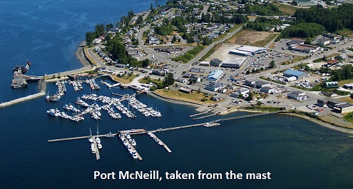
It was a beautiful day spent motoring 69 miles and we were happy to tie up at the Port McNeill Fuel Dock Marina and had dinner ashore. Provisioning and laundry were easy and are just a short walk away. This is a good stop for those in a hurry.
I knew the very next day was to be a long one and it was. Queen Charlotte Strait stood defiantly between us and northern BC. The winds at this time of year usually blow from the SE which would have been great. Of course, they were honking at 20 knots from the NW when we crossed. To be fair, it didn’t start out like that. In the early morning we had 10-15 knots and were able to sail on port tack a close reach. This allowed us the luxury of shutting off the engine for the first time on the trip. It was quiet and we were sailing! As we heeled, my oldest, Asmara (age 7) said, “Daddy, I’m not used to this.” The bliss lasted for exactly 50 minutes before the wind shifted to on the nose; their usual position.
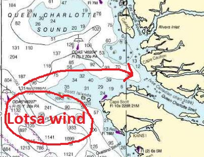
By the time we reached Pine Island Lighthouse wind was 15-18 knots WNW in the face and we were bucking four to six foot green swells. The crew was green as well. We powered into it at 6.5 knots and fought our way across with the girls taking turns feeding the fish.
Everyone was pretty tired by the time we anchored in Keith Anchorage, Calvert Island in 50 feet (N 51.38.850, W 128.05.519). 87 hard miles were won that day. I took out the bucket with knotted line and dipped it overboard. Scrubbing and more scrubbing removed all evidence of sick crew on port AND starboard.
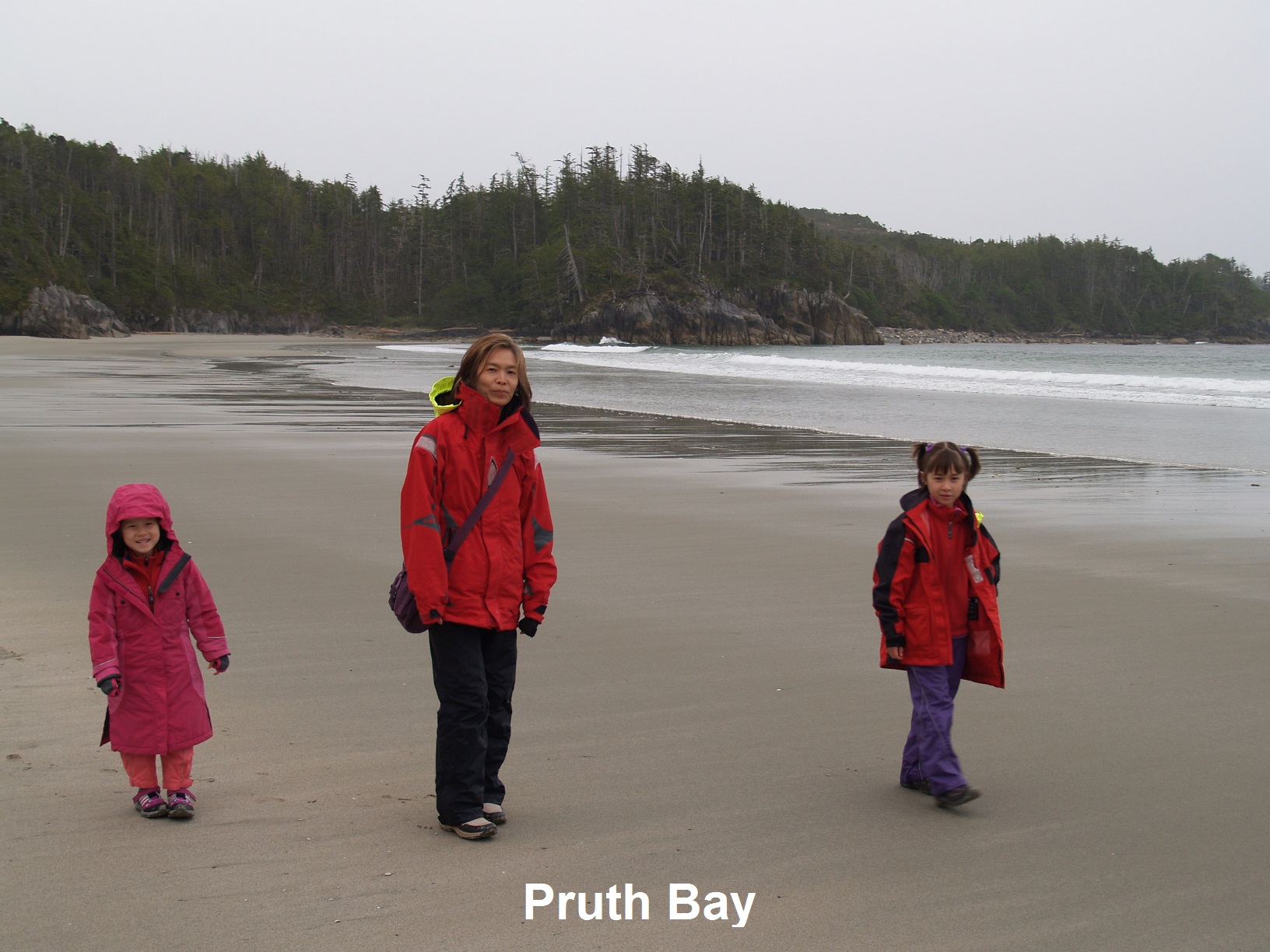
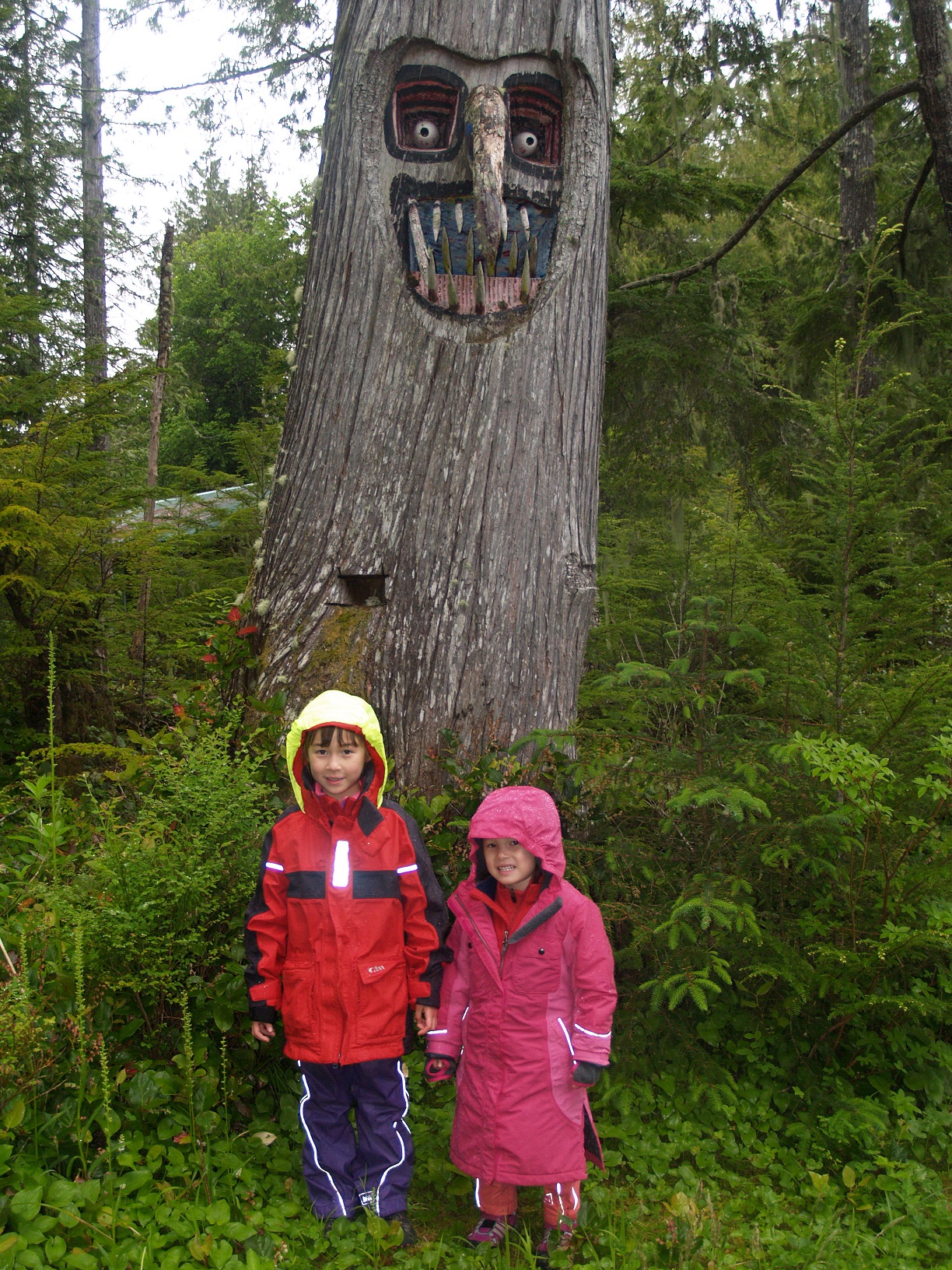
Calvert Island is home to Pruth Bay which has probably the nicest beach in BC. It was the only sand beach we have seen there. Facing the Pacific Ocean unprotected, the normally rock-strewn shores of the coastline have been mercifully pummeled into fine sand. There are pleasant walking trails from the docks of the Hakai Institute to the beach making this a great stop to wait for weather and stretch the legs.
The only wifi service we found in Canada is also here, courtesy of the institute. Sailors are welcome to walk through the property and use the internet. This is a rare privilege – and we certainly don’t do anything for them – so please don’t abuse their hospitality.
We spent the day there walking “through the fairy forest” as the girls called it. They loved shell-collecting on the beautiful crescent shaped soft sand beach and wading into the cold Pacific waters up to their ankles. It also rained the whole day we were there. Oh well, par for the course.
It was my hope to dart to the outside through Hakai Pass to Hecate Strait and continue our voyage. As the song says, “Oh, the weather outside is frightful….” The rain was coming down in sporadic sheets and the wind was howling a mournful song in the early morning dark. “Noooooooo. Doooooon’t gooooooo.” Right, scratch Hecate Strait then. We upped the 110 pound hook at 0530 and motored slowly through the pass into Finlayson Channel and were escorted by a handful of dolphins an omen which confirmed the wisdom of our choice.
That night, after 86 wet miles, we found refuge from the constant rain (and some swell) in Work Bay, Sarah Island (N 52.47.063 W 128.28.883) in 43 feet of kelp choked water. This was by far our smallest anchorage yet (and still is). The wind was 20 knots outside this hidden nook but inside the breeze was only half that. This still put us on a lee shore in the steady rain and mist. I noticed the shore was sand and mud and the anchor was set well, so the hell with it. I got up several times at night (as I usually do when unsure of an anchorage) to check on things but we never swung and never budged.
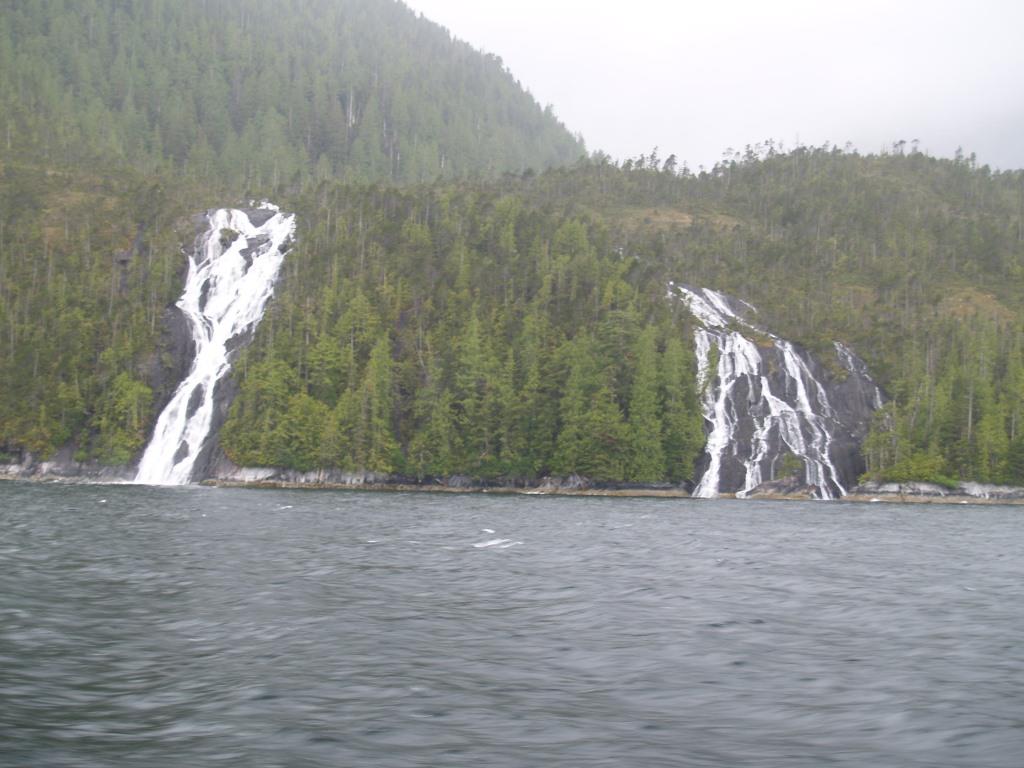
Much like trailer parks are tornado magnets, sailboats seem to attract contrary wind. After a rough crossing of Queen Charlotte Strait with 20 knots of wind gusting to 29 knots and always in the face, we entered the more protected waters of two mile wide Finlayson Channel. Instead of fighting wind, wave and tide now we would just fight wind and tide. Just north lay Grenville Channel and of all the channels I think Grenville Channel, 50 miles long with tree-clad misty mountains lining either side and random waterfalls tumbling down misty mountainsides like skeins of silk is the prettiest.
Spirit Bears
The channel twists around part of Princess Royal Island, the largest on the north coast of BC. Part of the Great Bear Rainforest, PR Island is home to the very rare Kermode bear, known to natives who live in the area as the “spirit bear.” These bears are white or cream colored even though they are the same species as black bears. Kermode bears are not albinos either but carry a recessive gene that, much like my red hair (ahem) gives them their distinctive beauty. The First Nations people (what Canadians used to call Indians) believed Kermode bears had special powers and as such they were never hunted. Mainstream knowledge of the existence of such a unique animal is a rather recent event as indigenous peoples were careful never to even mention these bears to fur trappers or biologists. We looked high and low for the elusive animals but all I saw through the mist were bear-sized cream colored rocks; and none of them moved.
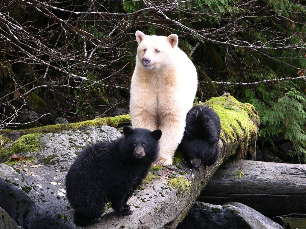
Luck was with another sailboat we met later in the voyage and they did see a Kermode bear. They were naturally brimming with excitement and told us they had watched the bear from their boat one morning amble along the shoreline at a place where they were anchored. I know the anchorage (and I’m not revealing it on the internet. Buy me a beer and I will tell you.) and we hope to check it out on another trip.
Kxngeal Inlet was our next anchorage, off Grenville Channel after powering 80 miles that day in the rain and mist. We were passed by our first cruise ship that summer, the Celebrity Millenium which was on its way to Ketchikan. I understand their engines fried not too long afterward and they had to cancel the whole summer sailing.
The weather could only be described as “wet.” It rained lightly every day and the accompanying mist hung just above the water like a floating fluffy blanket. Sometimes the mist moved out of our way and sometimes we motored into it and watched visibility drop to a few hundred feet. The soaring mountains vanished and all that we could see were just the sides of the channel. It didn’t matter though as I kept a close watch on our radar and peered at the water ahead with my fogged up binoculars, scanning for ships, logs and cream colored bears.
This was to be a short day and we only had 43 miles to go to Prince Rupert, our last stop in Canada before crossing into Alaska. We tied up to the grandly named “Prince Rupert Rowing and Yacht Club” in Cow Bay. Reality was a little less generous.
We spent the day in “Rainy Rupert” as the locals called it but we were lucky as the sun shined for us. Laundry needed to be done and heavy schlepping of such was required to get it to King Koin where they had that rarest of services: wash and fold. While we waited on that we ate in one of the dozen or so “Canadian Vietnamese” restaurants that freckle the town. Food was not great and all of the eateries looked empty.
PR is a dying town with many boarded up buildings and “For Sale” or “For Lease” or just plain “Forlorn” signs on every tired block. Even Pizza Hut gave up and closed. We even saw a church that went out of the soul harvesting business.
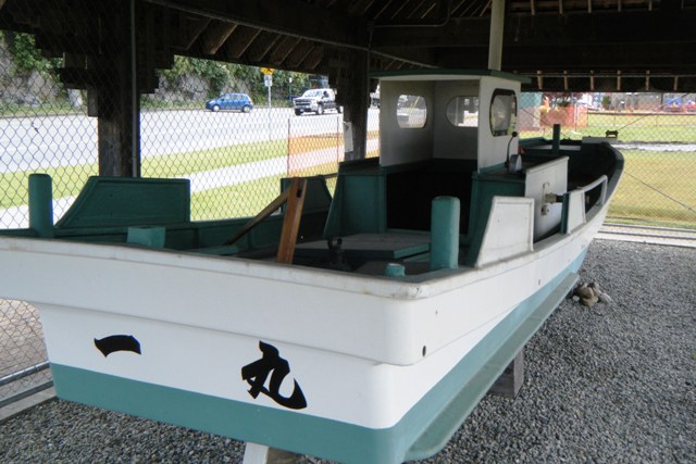
In the park on the hill there is a very nice shrine to the ”Ichi Maru,” a small fishing boat that washed up here all the way from Japan after spending one year adrift. Unfortunately, the owner was not aboard and his body was never found. While the locals call it the “Kazu Maru” after the first name of the owner, Kazuhiko, the Japanese name on the transom is “Ichi Maru” and it is the centerpiece of the seafarer’s memorial. The small inshore vessel has been lovingly restored and put up on display in a tasteful and respectful manner.
After spending a day in economically depressed Prince Rupert we left Canada, having wandered 590 miles so far and headed over the border to Alaska. Our first stop was 91 miles away: Ketchikan. Modestly calling itself “The Salmon Capital of World,” Ketchikan seemed like a big city to us with float planes landing and taking off, jet aircraft screaming down the runway across from the harbor, cars and trucks roaring along the roads and houses, people and cruise ships all piled high. Despite being the home of my favorite Alaskan artist, Ray Troll, we couldn’t wait to leave.
Although not in any of the guidebooks, there is a fuel dock north of Ketchikan thus obviating the need for us to backtrack from the marina which is also north of town. The sign on the dock loudly proclaimed, “Automatic 24-hours.” It automatically would not accept my credit card so we waited there an hour until 8 am when the attendant arrived. It was, for us, a slow start to the day.
An uneventful day of pleasant motoring saw us cover 74 miles. We anchored in Exchange Bay in 65 feet of flat water (N 56.12.528 W 133.04.132). A deaf black bear wandered out of the trees and grass on shore completely ignoring the roar of the chain flying out of our chain locker as the anchor raced to the bottom. Another quiet and happy night was spent on the hook.
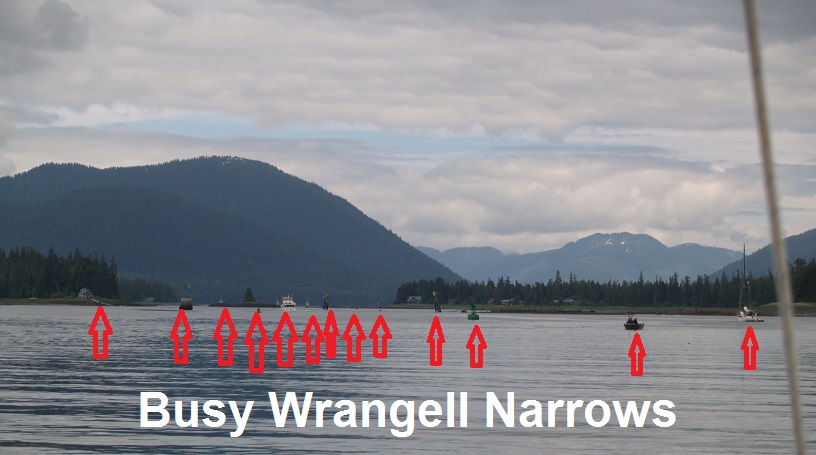
To get to our next stop, Petersburg, we had to time the tides and make it through the tortuous Wrangell Narrows – a very skinny and shallow 24 mile twisted stretch of water fenced in by an amazing total of 66 navigation markers. Get on the wrong side of just one of those marks and you will be aground, possibly for a long time. My long suffering wife, Ariel joined me in the cockpit to help keep watch and we ticked each marker off on the chart as we passed by.
While the name “Wrangell” sounds like something from a cowboy movie about “wranglers,” it is actually a Russian name. Wrangell town, island and narrows were named after Baron Ferdinand Petrovich von Wrangell, a chief manager of the Russian American company back in the 1830s. In later life he became a Russian admiral and minister of their navy.
Two and half careful hours later we emerged unscathed into the heart of SE Alaska, Petersburg; a real working Alaskan town with very few tourists. The shallow water keeps the cruise ships away leaving the town un-pawed and unmolested. Petersburg is a little taste of old Alaska for those who go. The city harbor charged us just $29 for the night with unlimited water and electricity, less than half other harbors we visited. Sandwiched in between real fishing boats and saving money at the same time, I liked this place.
Petersburg has a strong Norwegian heritage and was founded by Peter Thams Buschmann who built a cannery there in 1900. There isn’t much you can do to Anglicize the name “Buschmann” so locals ended up calling the settlement that sprung up around the town Petersburg. The town of Craig has a very similar history although the original “Craig” had the last name of Millar so why they decided to call it after his first name is a mystery to me.
The sun was shining brightly for the whole day as we motored 100 miles – our best yet – to round the bottom of Admiralty Island where we saw our first sea otter at the entrance to Chatham Strait, off Point Gardner. We anchored (twice) by Moses Point just inside Peril Strait off Baranof Island in a tiny cove. The normally unflappable Spade anchor scraped its way nervously across the asphalt rock bottom but set on our second try in 55 feet of water (N 57.25.017 W 135.04.290).
It was hot and still even in the late afternoon. We were plagued by huge stupid horseflies which were making the girls jumpy. My logbook entry for that time reads:
“Horseflies as big as lobsters trying to carry away the children.”
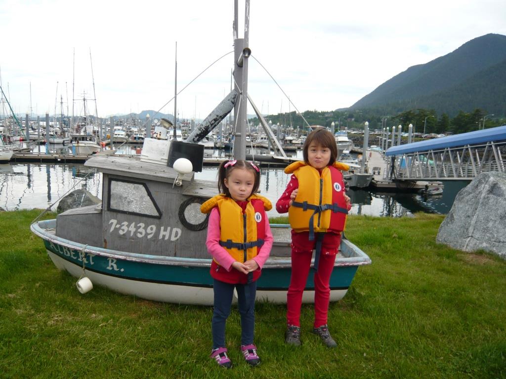
Only 54 miles separated us from Sitka and we made it through Sergius Narrows with no trouble near slack water, swatting horseflies the whole way. With its Russian Orthodox church, walkable downtown and what we learned was seemingly everyone’s favorite SE Alaskan town, we enjoyed Sitka. We had covered 950 miles in the last 16 days.
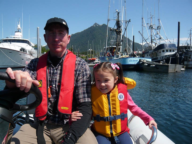
It was so warm when we arrived that mid-June day I had to wear shorts. We walked around the completely deserted town that Sunday. It was Father’s Day too but we didn’t know that until we saw a sign in a store window. When I turned and asked the girls, “Hey, where are my presents?” Adriana (age 4) looked up at me with wide eyes and said honestly, “I haven’t made it yet.” Asmara just shrugged and said, “Oops.”
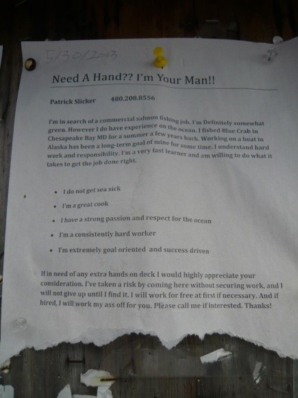
There are many ads in marinas and those in Alaska tend to be from young crew looking for work in the fishing float. I particularly liked this one, written by one Patrick Slicker:
“I will work for free at first if necessary. And if hired, I will work my ass off for you.”
Good luck, Patrick. I hope you found your dream job.
Planted on the edge of mountainous Baranof Island, Sitka bravely faces the North Pacific and was to be our jumping off point to cross the feared Gulf of Alaska, a nasty stretch of water that keeps most people happily shore bound. We spent a week here resting and provisioning for the 600 mile passage which would take us well out of sight of land. This crossing was the first for the girls and I was curious to see what they would think. Our destination, Kodiak Island, is located in the middle of the gulf just below the Alaskan peninsula surrounded by rough water and to get there takes a little effort. I know that effort will be repaid. Ariel, my often seasick wife, is less sure.