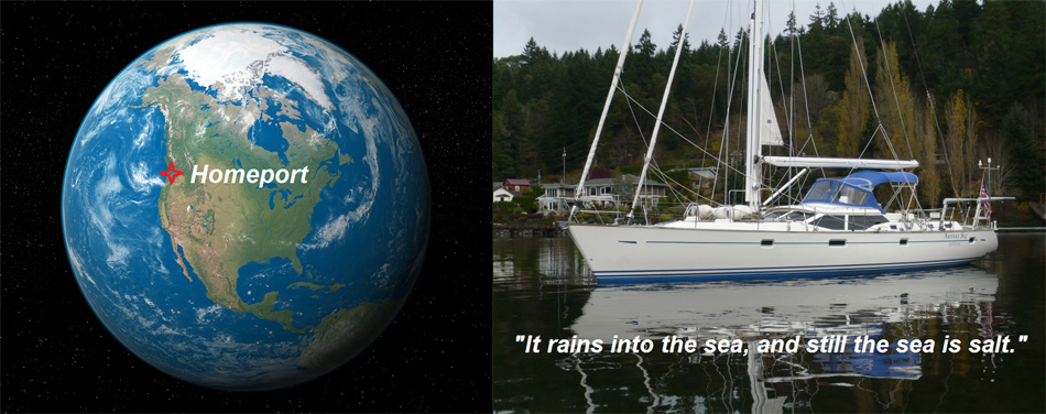
- Boat
- Articles
- About
- Tehani-li Logs
- 2004
- Uligan Maldives
- Man, Oh Man, Oman
- Eritrea: The Nicest Place You’ve Never Heard Of
- Cruising Notes: Oman to Eritrea – From Pirates to Cappucinos
- Old Testament Sudan
- Egypt: Legend, Myth and Reality
- Thoughts on Cruising the Red Sea
- Greece: Civilization Again
- Montenegro
- Malta
- Sardinia, Italy
- Barcelona, Spain
- 2003
- 2002
- 2001
- 2004
- Contact
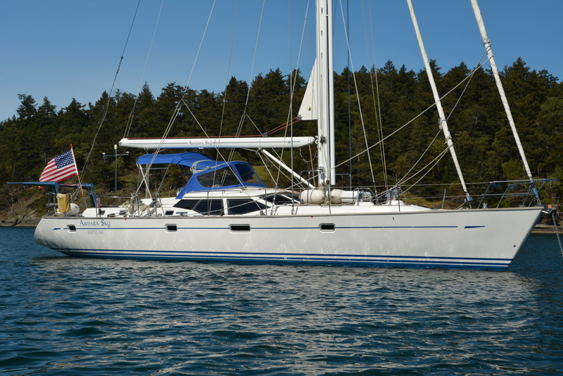
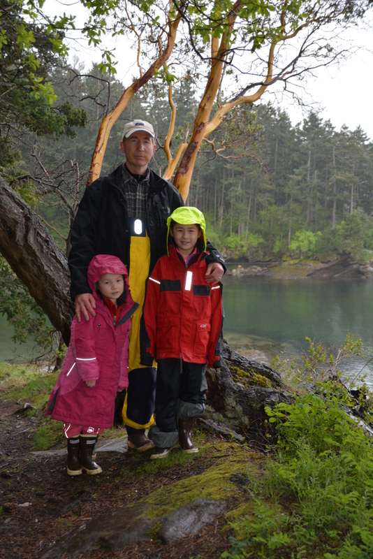
Cruising the San Juan Islands in Spring
The day of departure finally arrived. I had repaired the windlass, I had repaired the generator. And I even thought I had repaired the fridge. It was time to shove off. Departing at 0735 with the girls still in their bunks reading, there was no wind as we motor sailed up and out Puget Sound. Fortunately, we were able to ride the ebb tide north and passed Point Wilson light at 10 knots SOG, just before lunch. We were making good time and had an easy crossing of the non-threatening Strait of Juan de Fuca.
Entering Cattle Pass we struggled against a two knot ebbing tide and were surrounded on all sides with laughing tidal overfalls and gaping whirlpools as the busy water boiled around us. I was reminded there are some significant currents and tides in the region one of the things that make it so interesting to sail. As we approached Whale Rocks we saw a couple of massive Steller sea lions in the water surface next to us. These sofa-sized animals can weigh up to 2,400 pounds and had just come up for air watching us as we sped by. Unfortunately, there wasn’t enough time to take a picture so I am putting a chart here.
Nice enough
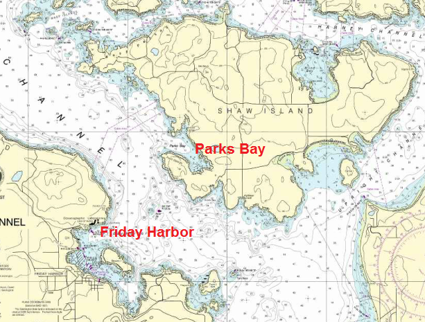
Looking for a quiet anchorage for the night, I chose Parks Bay on Shaw Island right across the San Juan Channel from always busy Friday Harbor. Thanks to its status of “Biological Preserve,” Parks Bay is one of the only anchorages in the islands not walled in by summer homes. While many people and certainly all newspaper articles seem to absolutely gush over the San Juan Islands, these over the top views, I fear, represent those of the land-bound. From the water the view of the islands is one crowded with large summer homes on private beaches with private docks. Most of these homes sit empty most of the year as the local economy cannot support 5,000 square foot palaces with waterfront views. As we cruise by sailboat we tend to be the type of sailors who seek out deserted islands and empty anchorages. Solitude and wilderness does not describe the San Juan Islands which is why I believe they are “nice enough” but hardly “gush worthy.”
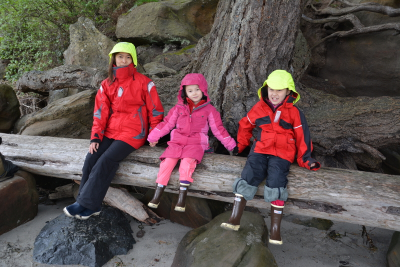
We spent an absolutely still and quiet night on the hook in the middle of Parks Bay, sharing it with a small Cape Dory, the only other boat there. Avian life was fairly prolific and Asmara and I with the bird book in hand and binoculars glued to our beady little eyes identified a great blue heron, two golden horned grebes, a few ducks called buffleheads (“That’s a funny name, Daddy.”) and even a yellow-billed loon.
Animals vs. fashion
In the past we just saw “birds” in the water. Now with the eager eyes of the children and armed with a bird guide we are seeing much more. Asmara in particular has an affinity for animals and keenly points out all the different breeds and types, whether horses (her absolute favorite), dogs, cats or birds. Adriana at five years of age, on the other hand, concerns herself much more with fashion.
Sitting in the rain shadow of the Olympic Mountains, the San Juan Islands are blessed with a drier climate than that of Seattle or coastal Washington. Many of the islands are hilly and forest covered. Yet, just as with “birds,” all the crew of Asmara Sky see now are “trees.” Botany is another area on which we should begin to concentrate. Madrona trees stand out amongst the maple, fir and cedars with their lean, stripped-down red or yellow trunks and twisted, gnarled appearance. Those we can identify readily but the rest, sadly, are for now at any rate just “trees.”
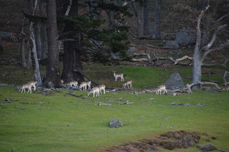
Here there are almost no sand beaches as the shoreline is rocky making good homes for basking seals and various types of birdlife. Long ago, wolves and elk used to populate the islands, as did the sea otter. All were wiped out with the arrival of Europeans who have demonstrated time and again they cannot get along with large animals. Needless to say, most of the wildlife in the San Juans today lives in the water and visiting by boat is the best way to see it.
Boss Juan
With many of the islands named for American heroes of the War of 1812 (Shaw, Decatur, Jones, etc), the area has an interesting, if offbeat history. Most of that history, while important, is lost to us. For perhaps 20-30,000 years the rich forests and bountiful seas of the area fed Native American tribes, the most recent of which are known as Coast Salish. The first European explorer to sail through the waters we were now visiting was Spanish explorer Francisco de Eliza who charted the area in 1791, naming the archipelago after his boss, the Viceroy of Mexico, Juan Vicente de Guemes Padilla Horcasitas y Aguayo.
From that long name we get “San Juan,” we also get “Guemes Island” and even Horcasitas was shortened to “Orcas,” as in Orcas Island. Many visitors assume the island, home of roving pods of beautiful killer whales was named after that glorious animal. Nope, the island was named after Señor Guemes Padilla Horcasistas y Aguayo, a great reformer in the Spanish administration, who nevertheless felt the Pacific Northwest was not worth developing. As careful readers may have noticed, Seattleites disagree with the considered views of Sr. Guemes Padilla and have been developing the islands at a rapid pace ever since.
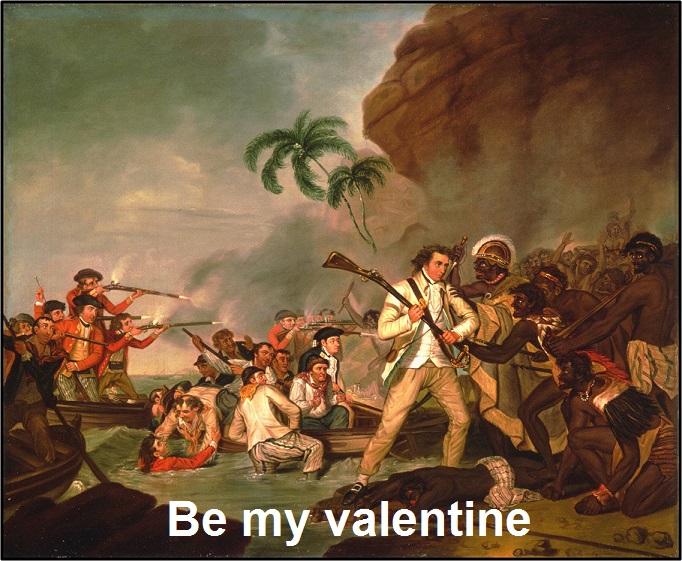
The very next year in 1792 saw the arrival of Captain George Vancouver on HMS Discovery. George “learned the ropes” sailing with the immortal Captain James Cook on Cook’s second and third voyages and he was there when Cook was killed by a mob of Hawaiian warriors at Kealakekua Bay on the island of Hawaii on Valentine’s Day in 1779. Eventually promoted to captain, Vancouver was the first Englishman to chart the Pacific Northwest, like the name of his ship, his was truly a voyage of discovery. Many place names Vancouver bestowed on his incredibly accurate charts remain with us today, notably the volcano peaks visible from the water: Mt. Baker, Mt. Hood, Mt. Ranier and even Mt. St. Helens. Puget Sound he named after his virile lieutenant, and father of 11 children, Peter Puget.
The Pig War
“The Pig War” is perhaps the most memorable piece of recent history that occurred in the archipelago. The incident was more of a territorial dispute between the US and Great Britain over ownership of the islands and not really a “war” as the only casualty was a pig shot on San Juan Island. The porcine victim was caught eating the potatoes of an American farmer in his garden and dispatched with one shot. The American refused to agree to rather exorbitant compensation demanded by his irate Irish and now pig-less neighbor. British authorities made moves to arrest the American farmer and local settlers called for US military protection. The farce escalated to the point of both the US and British establishing military forts on the island to watch each other.

They “watched each other” for 12 years. Both sides were friendly however, and copious amounts of beer were enjoyed in each other’s company over the time period. Eventually, much to the probable disappointment of the well-hydrated soldiers, the crisis was eventually diffused by politicos in Washington and London via arbitration of Kaiser Wilhelm l of Germany – of all things – who finally decided the permanent boundary between the British Dominion of Canada and that of the United States. The pig died in vain. The territory belonged to the United States.
Unconcerned with such weighty matters, the second day for us dawned a quiet and sunny morning. The crew of Asmara Sky enjoyed a lazy morning after a peaceful night swinging gently on the hook in the mill pond conditions of Parks Bay. We pulled up the anchor (the windlass worked again!) and motored 16 miles up to Sucia Island which, we had been told, is one of the more isolated parts of the archipelago.
A bad pun follows
Another Spanish name, “Sucia” means “dirty” and this refers not to the island itself but to the rocks and reefs that surround the entrance. We passed through the hazards easily enough and anchored in 26 feet in Echo Bay. A large anchorage that could hold 100 or more boats, we had Echo Bay to ourselves. This anchorage is apparently jammed in the summer and as we dinghied ashore I could see this was the case when we passed a permanently moored pump-out station. I had never seen one moored like that in a (now) deserted bay. Its presence spoke of hundreds of boats commonly anchored in the bay, cheek by jowl. The summers must suck here, I thought (no pun intended).
Sucia Island is one of the more northerly of the San Juan Islands, and looks like a blown out comet arcing over the archipelago as it races toward the Canadian border. Echo Bay offers great protection from all directions but the east and the holding was excellent. Breaking out the anchor when we left required using the engine and our 25 tons of boat mass to release the deeply buried hook.
The sun continued to shine and we embarked on a gentle hike to explore this “more isolated” island. Trails are wide, well-marked and are hardly trails at all. In fact, while we were having a picnic at a table on the beach a truck drove up and two people jumped out to work on the bathrooms. Then a quad drove up with another supervisor. This on the wildest of the San Juans tells you a wilderness experience, it ain’t.
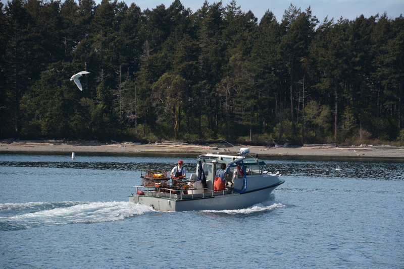
Back aboard for the afternoon nap (cruising is hard work), I watched from the cockpit as a local crab boat pulled into the bay. He buzzed from pot to pot non-stop like a bumble bee humming from flower to flower. They came within two boat lengths of us and never even looked up from their work. A few minutes later they buzzed off. Those guys work hard, I thought, grinding out a living like that.
The sun is very fickle at 48.45 degrees north this time of year and the next day it decided not to join us. We were left with old friends cloud and rain. The fridge started to act up. Under normal operating conditions the refrigerator on board should take between 20 and 30 minutes to get down to the correct temperature. Now it needed four hours and was completely draining our battery bank in the process. If we plugged into the dock at Friday Harbor it could run all day, for all I care, I thought. I shut the damn thing off and figured maybe tomorrow it would feel like working again. We spent our last afternoon on board soaking in the off-season quiet at Sucia Island before leaving at first light.
A circumnavigation

Of course, we needed some navigational challenge on this trip. So we decided to circumnavigate Orcas Island before proceeding to our next anchorage. This sounds far more dramatic than it is.
Sail Factory Number One
A 0710 departure the next morning saw fair skies and a fair wind. It was time to hoist the new main sail. I had just bought this HPV main (high performance vectran) from Island Planet Sails which had it made in Sail Factory Number One in China and shipped it over to me. After bending on the sail it looked good and I was keen to see how it worked in the real world. With a nice shape and light breezes the sail performed well. We won’t know for sure however, until we go offshore and give it a real beating. That wasn’t to be this trip which was more a restful walk through the park.
Shaped like a crab coming at you with oversized claws, Orcas Island at 57 square miles is the largest in the archipelago but is less populated than San Juan Island. Orcas is also fairly mountainous and every peak and shoulder had a big house on it with great views I would imagine. We transients in our floating home are just part of the scenery. It is nice for them and for us too. The highest point in the San Juans is Mount Constitution, found on Orcas which reaches 2,409 feet up to the sky. The view from the top must be spectacular on a clear day like today, I thought.
As we sailed by the northern part of the island I noticed a Chinese-looking tower perched atop the peak. It looked like a guard tower from the Great Wall of China but is actually an observation tower built in the 1930’s by the Civilian Conservation Corps and a copy of similar towers found in the Caucuses in the 12th century – for some reason! Quirky, original, indeed it was cool.
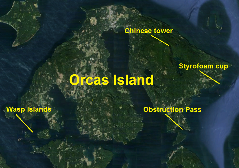
We rounded the southern part of the island on this beautiful sunny morning and made our way through Obstruction Pass motorsailing 7.5 knots with the new main up. The fridge had decided to go to work again; all was bliss. Weaving our way through the treacherous Wasp Islands completed our circumnavigation. I have been told, given the many rocks, reefs and the tidal change in the area, the Wasps are where most boats cruising the islands which come to grief get “stung.” For anyone with a chart and paying attention however, it is not too challenging.
Thirty-one miles after leaving Sucia and circling Orcas we anchored in 27 feet at Reid Harbor on pretty Stuart Island. This was a bomb-proof anchorage and there were only two other boats there with plenty of crab pots. Despite the straightforward entrance a night entry would not be advisable given the large number of pots we had to weave through.
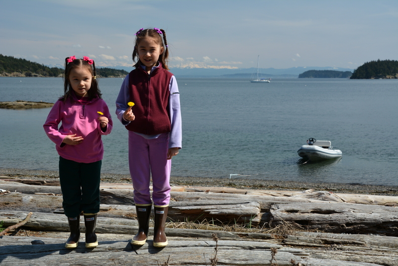
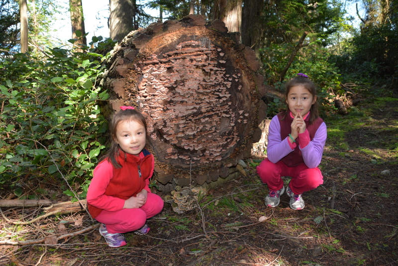
After lunch we lowered the dinghy and went ashore to walk around. Stuart Island was hilly but there were few houses giving the place a little more of a wild and unmolested feel to it. We liked it and enjoyed our short walks. It is always good to get the girls off the boat to do a little beachcombing or easy hikes as short legs cannot go far.
A long a difficult relationship
Our water tank was getting low so I carefully approached the watermaker. I have had a long and difficult relationship with this deeply flawed piece of junk. The unit makes fresh water from seawater by forcing the salt water through three ceramic membranes at 850 psi. The membranes filter out salt and dirt particles leaving only fresh water. It only works now and then and is quite temperamental. An original piece of equipment installed on the boat when she was built 12 years ago, the SeaFresh Watermaker was built to British design making it a) unnecessarily complicated, b) unnecessarily difficult to use and finally c) unnecessarily expensive to fix. I had spent two years and thousands of dollars to make this thing get us through our various trips and it was always with some measure of trepidation that I fired up the generator to power up that watermaker.
As usual between us, things did not go well. We could not produce water fit enough to drink according to our TDS (total dissolved solids) meter. This was a problem. Fiddling around with the membranes only caused a leak that sprayed high pressure salt water all over the main engine as the damn thing is located in the engine room. After working on it some more and reaping the same bitter result I came to a decision. It was time to part ways. The only thing going through my mind at that moment was whether to rip the water maker out and toss it overboard right now or wait until we were in deeper water!
But life is short
Life is too short to drink cheap beer and too short to live with recalcitrant and tetchy watermakers. By economizing on water that day we would have enough to get us to Friday Harbor where we would tie up to the dock and “water up” as well.
The night spent at Reid was the way we like it – perfectly calm and flat. We choose our anchorages carefully and the number one requirement is protection. If we can go ashore too, even better but it has to be protected. We don’t like sleeping with one eye open, rocking and rolling all night in some open roadstead listening to the deep grumble of the chain as it grinds its way over rocks.
As the sun began its ascent into the clear sky we upped the anchor and left quiet Reid Harbor at 0710. Less than two hours later we were tied up to the inside of the breakwater at Friday Harbor Marina. There we met Richard, Jude and Katya on lovely Sarita, a Hallberg Rassy 46 which had spent the winter in Friday Harbor after a five month cruise in Alaska the summer before. We invited them over for drinks that evening and they repaid the courtesy by having us over for lunch the next day. It was a real treat to spend time with other cruisers. He is British and she is Australian and we enjoyed their international perspective on things.
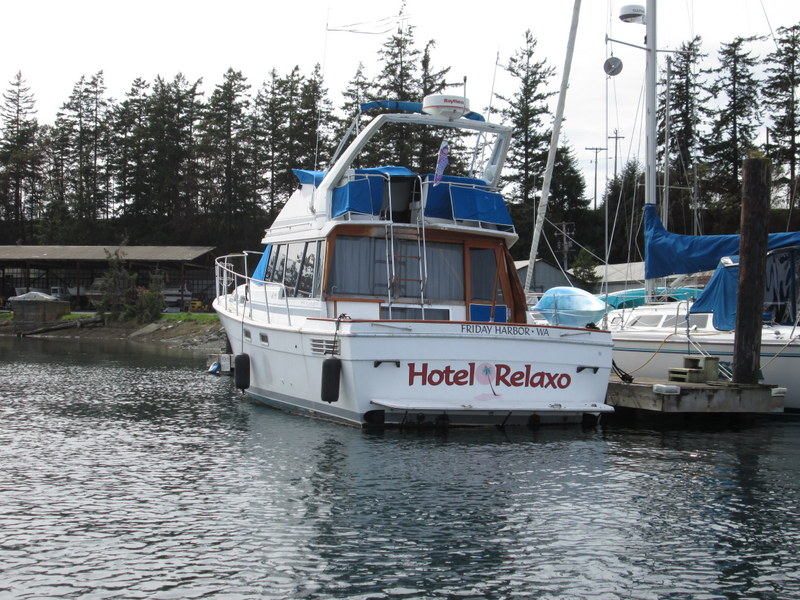
The next day Asmara and I dropped the dinghy and went exploring. We motored around looking at boats and down to the bottom of the harbor where the boatyards are. That is always interesting and despite the chill in the air we enjoyed it. I loved the name of the old Bayliner, “Hotel Relaxo.” You know they have a good time.
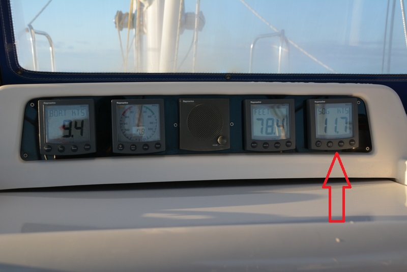
After two nights in the big smoke of Friday Harbor it was time to go home. We quietly slipped our lines at dawn and headed south. Catching the ebb tide again allowed us to shoot out of Cattle Pass into the Strait of Juan de Fuca at 11.7 knots SOG!
An uneventful crossing of the Strait under overcast skies and threading our way down the Sound found us back in our slip at Shilshole Marina shortly after lunch. We tied up, unloaded and drove a tired and weary crew back to the house. During the seven days on board and the leisurely 179 miles covered everyone had had a good time; the mark of a successful cruise.