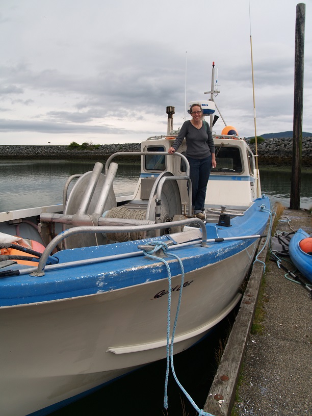
- Boat
- Articles
- About
- Tehani-li Logs
- 2004
- Uligan Maldives
- Man, Oh Man, Oman
- Eritrea: The Nicest Place You’ve Never Heard Of
- Cruising Notes: Oman to Eritrea – From Pirates to Cappucinos
- Old Testament Sudan
- Egypt: Legend, Myth and Reality
- Thoughts on Cruising the Red Sea
- Greece: Civilization Again
- Montenegro
- Malta
- Sardinia, Italy
- Barcelona, Spain
- 2003
- 2002
- 2001
- 2004
- Contact
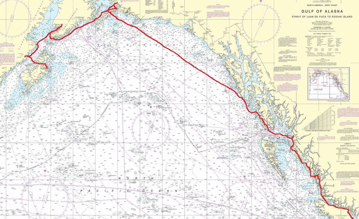
2,000 Miles Home
I’m Scared of It All
“I watch the wan faces that flash in the street;
All kinds and all classes I see.
Yet never a one in the million I meet,
Has the smile of a comrade to me.
Just jaded and panting like dogs in a pack;
Just tensed and intent on the goal;
O God! But I’m lonesome…I wish I was back,
Up there in the land of the Pole.”
– Robert Service
It was time to leave the emerald isle of Kodiak and we raced through Whale Pass again, this time 30 minutes after low tide and rode the ebb in the early afternoon. I watched with interest as our speed over the ground hit 13.5 knots for the first time. We averaged 12-13 knots for most of the half hour trip where we saw lots of birds and two whales feeding. Many birds seem to almost always be an indicator of whales feeding.
Instead of crossing Shelikof Strait when it was getting dark and winds are normally at their highest, we decided to drop the hook behind Dry Spruce Island in 50 feet of water (N 57 57.011, W 153 03.054). This was one of our short days as we only covered 34 miles.
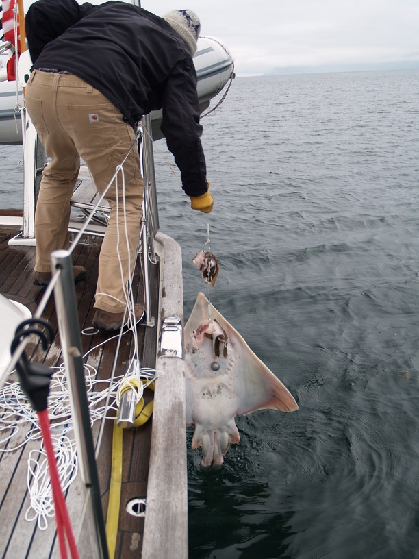
I tossed out our “meat hook,” a halibut rig with two heavy lead balls on the end, and let it stew overnight. The next morning I had something heavy: halibut! I called everyone over and commenced hauling in the line hand over hand. It was strange because whatever was on the end wasn’t fighting at all. As it got closer to the water I saw it was a big fat skate which must have weighed 30 pounds. I pulled the slimy skate out of the water to free its grooved stupid mouth from the hook but the animal was so lethargic it never moved anything other than a lazy flick of its tail – the part with the stinger. While skates are good eating in other parts of the world they don’t eat them in Alaska and I was not going to mess around with this one. He plopped back down into the water with a splash once free of the hook to pursue an undistinguished career in the depths as a low energy denizen of the deep.
We were headed that morning to Kukak Bay, part of the Katmai National Park and Preserve and the place where self-proclaimed “bear whisperer” Tim Treadwell got eaten by a grizzly. I don’t feel badly for what happened to him as things like that happen regularly to certifiable idiots. The unsung heroine of the whole thing was his girlfriend who fought off the bear and was also subsequently eaten. She I really feel for.
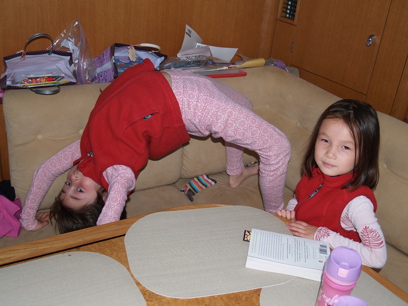
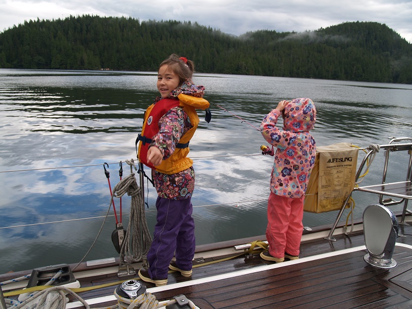
Getting to Kukak required crossing Shelikoff Strait which we did in the morning drizzle with wind 10 knots on the nose and bucking 4 foot swells and a 1 knot tide (against). It was a little bouncy and my log notes “girls are not so chipper.” Here is what they look like when “chipper” and playing down below:
The wind built from 10 knots SW for the first one-third of the crossing to the forecast 20 knots SW for the second one-third. Then it built to 25-30 knots SW for the last exciting one-third. We had water over the decks and were booming along under sail with a few waves even reaching the dodger on our center cockpit boat. Three hours and 10 minutes later we entered the sheltered waters of Kukak Bay. We had averaged 8 knots on the crossing and dropped the hook just after lunch behind Auligik Island in 60 feet (N 58 18.356, W 154 11.824). Total distance covered that day was just 47 miles. It was July 15th and we were exactly halfway in to our three month trip.
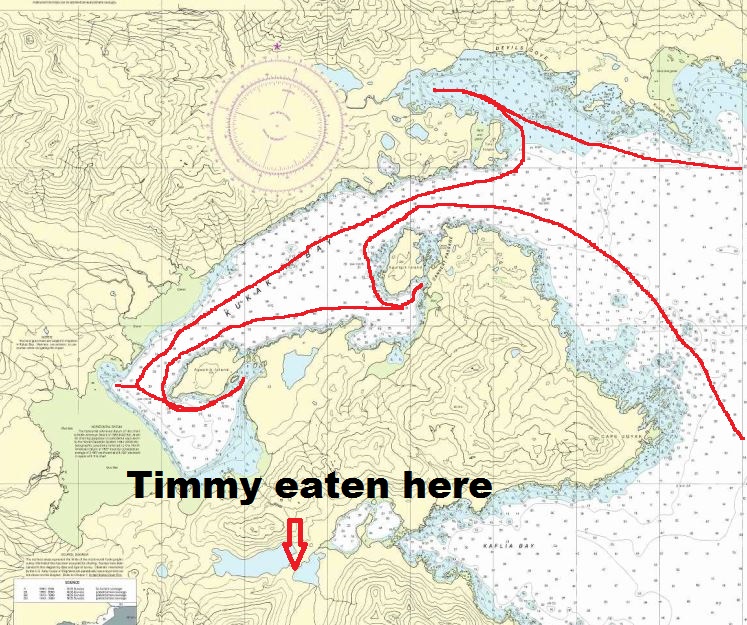
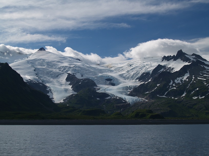
After a quiet night we anchored 5 miles further inside Kukak this time behind Aguchik Island in 59 feet on a clay bottom with excellent holding (N 58 17.341, W 154 15.941). The water here was much more milky and opaque due to the runoff from Hallo Glacier which hangs in the air over the mountain peaks providing a spectacular backdrop. We saw two grizzlies on the other side of the bay foraging below soaring volcanic peaks capped with brilliant white snow and ice. We were about two miles from the spot Timmy got munched but I didn’t mention that to Ariel until we had left the park.
After enjoying another secluded very private anchorage for a couple of hours in chugs mega yacht “Kaori.” Attended by numerous uniformed crew, they dropped two anchors off the bow well behind us. Measuring 125 feet long and built by Palmer Johnson to a Chuck Paine design – we DON’T get invited over for canapés and caviar…. Oh, well.
The next day we took the dinghy around to the front of the little island of Auligik and found a big grizzly on the other side foraging. We motored in close to him and he flopped down on the grass and started eating the green stuff. I turned off the engine, carefully watching the depth, current, wind and tide, as all of us quietly enjoyed this close encounter. I managed to capture it on video and the girls were totally entranced. Once we drifted a little too close I quietly started the motor and we gently left him to his breakfast.
On our third day we moved the boat again, all the way to the head of the bay to see more bears. After two sunny and calm days the winds began to blow a bit and we had 20 knots, gusting 25 for the next couple of days. We holed up at our anchorage protected from any chop facing into the wind coming right off the land in 25 feet with a silt bottom (N 58 17.304, W 154 19.263). At this spot only were we able to get NOAA weather information on VHF.
So we are stuck here in a bear sanctuary watching the big grizzlies wander the shoreline as the wind howls and the waves bounce. We had hoped to leave for Homer yesterday but the weather forecast called for 30 knots and seas of 8 feet in the Shelikof Strait which we have to ride for 100 miles before crossing Cook Inlet and Ariel smartly pointed out that was just not on.
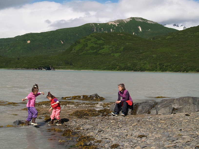
Today the forecast was for 35 knots and seas of 9 feet. At least in our anchorage here there was no wind in the morning whereas yesterday it kicked up to a steady 20-25 knots by breakfast and honked all day. The girls love beachcombing and we piled into the dinghy after breakfast this morning to “collect pretty shells, Daddy.” Not only geologically is this part of Alaska, just 27 miles away from Kodiak different than that island but there don’t seem to be many shells on the beaches here either. This meant the shell collecting expedition became a rock collection expedition but that hardly dims the excitement. At least with all the volcanoes there are small bits of pumice scattered around that float, “Look girls, floating rocks!” We had to collect those.
The landscape and weather of Katmai is much drier than Kodiak. The steep mountains backing the bay are green with trees, grass and bushes climbing to their shoulders above which they suddenly turn to red and gray volcano-blasted moon rock. This is volcano land and part of the 4 million acre Katmai National Park is called, “Valley of Ten Thousand Smokes.” Kodiak was a much deeper and more luscious green and had no random bushes like here.
By the time the ladies had filled up a little baggie of indeterminate stones and beach detritus it was snack time on the beach. The wind kicked up again and we had a bit of a wet slog back to the boat in the dink bouncing over the steep, sharp one foot waves and bucking the 20 knot breeze. Everyone got back aboard safely and happy at the conclusion of another successful outing.
NOAA VHF forecasts come in on the radio all over the US but here, deep inside the Alaska Peninsula we cannot get them reliably. To get the signal I am dependent on which way the boat swings at anchor. It seems I get a fuzzy 2-3 day forecast, “Winds 25-30 knots southwest, seas 7 feet,” until the area concerned is mentioned whereupon the boat promptly swings on the hook and the radio frustratingly goes silent. Repeated listening as we swing to and fro, I shush the girls’ chatter and my ears grab bits of the puzzle allowing me to piece together a forecast. We stay put another day.
Hey, Bear! Ho, Bear!
Bears are the reason we are here and they too enjoy beachcombing, usually at low tide. We watch them shuffle along, always alone, snuffling up things that to a bear at least seem delectable. To avoid being included in that menu we tend to hit the beach at high tide and make a lot of noise as we move along the shoreline, “Hey bear! Ho bear!” The girls are pretty used to bears and spotting one now from the boat only elicits mild interest. Asmara will climb the stairs, look at the animal across the bay for a few seconds and then go down and return to her book. Adriana doesn’t even bother coming up. Children are nothing if not adaptable. What just a few weeks ago seemed exotic, scary and exciting now is ho-hum everyday fare. Whales get the same treatment. “Look, a whale!” I shout. “Oh, yeah. I see it, Daddy” and nose goes back to book.
That afternoon as the wind howled around us I started playing around with my SSB (Icom) for the first time on this boat. I had put in a new antennae and we could receive but as of yet had not transmitted anything. I came across the NOAA forecast on 4125 MHz at 1645 hours. After listening carefully, I heard the guy say he was based in King Salmon and were there any requests. Grabbing the mike I asked for a repeat forecast for our area. He acknowledged and began to read it out to us – the SSB works! Subsequently I read in the back of the Coast Pilot there is a short wave schedule for WX forecasts and current conditions on various frequencies around Alaska. Good to know when you don’t have a VHF signal.
Naturally, there is nobody here to share the mountainous amphitheater of rock and water that is spread out before us. The luxury Katmai Wilderness Lodge is seven miles away at the entrance of the bay and twice a day they furtively send a fast boat or two with pampered guests aboard at high speed out to see bears. The boats roar by in the morning and as I pop my head out to wave and see who it is, I might get an answering wave or not. The tourists are high end consumers with just a short time for their wilderness experience and spend $1,000 a day or more for it. All amped up with designer coffee and their own guide in a fast boat as they fly down the mile wide bay scanning for bears they probably feel a letdown to suddenly come across a family boat at anchor from Seattle right in the middle of their wilderness fantasy. I guess no longer can they tell their friends about how isolated they were and how “wild” the trip was. Sorry about that, guys.

This morning the tide was way out and the mud flats had crept up much closer to the boat. Instead of 25 feet of water we were now sitting in 12. I got up at dawn as usual and was shaving when I looked out the porthole and saw a bear padding by. He was maybe 50 yards from the boat and walking along the mud flat in water a few inches deep, slop-slop-slop I heard him quite distinctly. I grabbed the video camera and got some footage of him walking by, the sun rising behind us bathed the scene in a warm glow. He stopped and looked at us for a few seconds and then continued his breakfast patrol. A few seagulls were standing there on the mud now a couple boat lengths away quietly taking it all in.
Another skiff roared by just before sunset. They came close enough to the boat so I could see their faces. I came out in the cockpit and waved but the tourists just stared blankly as they flew by. Their guide waved. I guess it takes a few weeks, time most people these days don’t have, to step outside the race and relax. “Tensed and intent on the goal” they pass us by at speed coming and going.
The wind may blow in the day but at night calm returns stealthily to the anchorage. The waves soften and melt away leaving all quiet again. When we sleep it is still light outside until after 11 pm. I wake during the short night and if it is dark, never pitch black but just “darker,” then I know it is still early and I have no need to get up. The only time I look at the clock is to judge the tides. I hear the lapping of little waves against the stern as the boat swings gently away from a light breeze. She too sleeps and all is silent once more.
We choose nice anchorages or they choose us, I don’t know. Every place we stop for the night we have to ourselves. Surrounded by miles of wilderness with untouched mountains soaring to the clouds on three sides in a warm embrace we settle down to another wonderful evening. Daylight breaks and I am up to watch the fish jump and maybe spot a bear walking the beach.
An Outdoor Girl
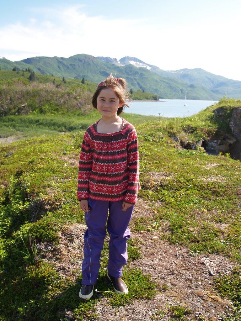
Those fish are smart or at least they have outsmarted me and all my expensive fishing gear newly purchased in Seattle. Asmara loves fishing with me even though we almost never catch anything worth keeping. She stands on deck swathed in her bulky life jacket holding her little three foot purple girls fishing rod jigging patiently up and down, up and down. “Daddy, are we going to catch a fish tonight?”
In one of the many “activity books” her mother brought on the boat to keep her occupied Asmara took a little quiz and was absorbing the results. “Daddy, it says here I am an ‘Outdoor girl.’” I couldn’t be happier.
We spent the early afternoon today exploring another beach. I have to keep moving the dinghy out into deeper water as the tide recedes and here it moves pretty quickly. We have gotten used to 20-foot tides by now and I find myself checking the tide; when is high, when is low, etc. as much as I used to check the time on land. It is a nice change and gives me a more natural rhythm. The girls love collecting all sorts of shells and we return to the boat with bags of them. I have no idea what the plan is for the 16 tons of shells on board once we get back to Seattle. Asmara, ever the business woman, wants to sell them a dollar each “to all my friends.” Thinking of Amway I haven’t explained to her she won’t have any friends left if she tries that.
When the tide is nearly all out and the tide pools and beach picked clean I herd the children back to the boat and leave the area to the bears. They like to come down at low tide and snack on whatever the sea has left for them. I do not want to interrupt their rhythm and happily turn it over to the rightful proprietors.
A glacier in our backyard
Three days of waiting out the weather in the same spot told me it was time to move. It took 20 minutes to break the anchor out of the clay bottom that had held us so well. This time we motored out to the entrance of the bay and anchored near the Katmai Wilderness Lodge, and dropped the hook in beautiful Devil’s Cove in 30 feet (N 58 20.946, W 154 11.647). The only way to get here is by float plane or boat and again, it is painfully beautiful and we enjoy the visual symphony eternal and provided by nature for just us. Behind us is the edge of Hallo Glacier hanging over the edge of a tall and stately mountain. Sitting in the cockpit and taking in the view with my oldest I ask her, “Asmara, how many people have a glacier in their backyard?” We are truly lucky to steal away in our time machine to experience and revel in such lovely surroundings.
It takes my breath away to read relatively recent accounts of visitors to Montana in the 1800s when the only way there was by horse or river boat up the Missouri. The commonplace tales of scenery abounding in wildlife with herds of bison blackening the horizon and elk grazing on every bend in the river is quite moving. The scenery, to be sure, is still there as the mountains have not moved and Montana and Wyoming are spectacular places in their own right even if they lack water (no ocean) but over the course of a relatively short period of time the land has been parceled and fenced, towns have sprung up across the prairies and along the valleys and every view stretches above telephone lines that sag from hilltop to hilltop. The animals are there, in much reduced numbers and on much reduced rations. They are wise to the ways of man now and sightings are rare enough to make everyone stop their truck on the roadside and look. And we have a glacier in our backyard.
I keep telling Ariel the time to see these incredible things is now. It may always be beautiful but as history is my guide when my daughters are my age it won’t be as it is now. Alaska will be “wilder” than the lower 48 but maybe not as untrammeled and untouched with access open to anyone who shows up the way it is now.
On an early voyage a decade ago in our previous boat, Ariel and I sailed to the Andaman Islands, a string of beautiful subtropical gems that belong to India and whose white sand beaches are washed by the gentle Andaman Sea. This is where the jungle industry of felling teak trees and hauling them down the hills to the beaches is done by elephants. King cobras slither in the shadows eating lesser reptiles and ignoring man unless provoked. The waters are blue and filled with tropical fish and beautiful Zen-like manta rays.
When we arrived we had to check in to the country with various officials visiting the boat, as is customary every place in the world one goes by sea. I remember well the rail thin young customs officer who stepped aboard with his weathered uniform and beaten satchel of forms to see our passports and have us fill out forms in triplicate.
“And captain,” he addressed me, “may I see your license?”
“What license?” I inquired rather puzzled.
“Your license captain, to sail this vessel.”
(One of the neat things of owning a boat is everyone calls you “Captain,” no matter where you go). I explained to him that one was not necessary. It was his turn to be puzzled.
“But how do I know you are qualified?” he asked.
I told him somewhat facetiously, “Well, I found this place in the middle of the ocean, didn’t I?”
Much time was spent going round and round with my trying to explain that I was American and this was an American boat and in the US one does not have to have a license to sail places. He was truly amazed and probably a little skeptical. It reminded me of how much freedom we have living like this and how it is unusual in the extreme. I pulled out my official looking boat stamp which I had made by a Chinese merchant in Thailand for five bucks and he visibly relaxed. Everything was going to be fine.
Large parts of the world remain off limits to free spirits of the sea such as ourselves; Russia, China, Vietnam (all paranoid and places that probably have something to hide). Others will only let you in under an onerous system of permits and restrictions such as Indonesia or even modern Japan. As a card-carrying infidel I am not even allowed to place an unclean foot on any of the spectacular coast line of Saudi Arabia. We sailed up the Red Sea a number of years ago and had to stick to the western side the whole way, bypassing that firmly closed desert kingdom on the right.
Licenses, regulations, rules “to protect you,” etc. are multiplying and growing with tumor-like speed everywhere and I foresee a time when step by step this incredible freedom we now enjoy and sometimes take for granted will one day be curtailed. Maybe as an old man I will return to the Andamans by sea and visit my now old and now portly customs officer and actually have a beaten satchel myself full of reams of paper and licenses to “protect me” and which “permit” me to do this and that. He might be happy with that but I shudder at the thought. Yes, the time is now to venture forth and explore and taste of the world all the wild beauty that it has to offer those who are ready.
As we ventured out into the strait and said goodbye to our home of Kukak Bay for the last week I reflected that we have now sailed 2,000 miles this summer and still have a long way to go. Turning the wheel hard to port I raised the mainsail to the first set of spreaders. I played out the boom using the preventer to control the progress and watched as we caught the wind; our speed picks up from 4 knots to 8. Time to shut the engine down and hang on.
Our destination was Homer, on the bottom of the Kenai Peninsula and across boisterous Cook Inlet. We have old friends we wanted to visit but getting there is not easy. The winds come from the west at 20 knots and push us down the strait in bouncy conditions. I have full jib out and reefed main and we maintain a steady 7 knots over the ground.
The forecast for Cook Inlet was still not that great so we decided to anchor in 25 feet behind Cape Douglas at the very edge of the Alaska Peninsula (N 58 49.930, W 153 20.930). The bay we are in is wide open and as I expected we spent a rolly night at anchor.
We are now in the area the 33 foot tides begin, where massive amounts of water flow in and out the 180 mile long and 50 mile wide Cook Inlet. Adding to those navigational factors that must be considered, the entrance to the inlet sits at the confluence of Shelikof Strait and the Gulf of Alaska. It is a rough neighborhood and we were there to cross it.
The next morning after Ariel and I got zero sleep but the girls slept as if they were on land in bed, we stuck our nose out and were immediately hit by the forecast 25 knot northwesterlies. This was great and gave us a beam reach. The seas were well behaved and we rocketed along. Again, the forecast only modestly hinted at real conditions. A few minutes into our ride the wind built to 30 knots, then 35 knots steady. I furled the main way down to just the first spreader and only had a scrap of foresail out. The seas were four to six feet and the wind gusting into the low 40s. I saw a gust reach 52 knots but was careful not to tell Ariel who, with the girls, was bundled up, life-jacketed and in the cockpit hanging on. A few exciting hours later the blasts died to just 30 knots, then 15 and then zero. We motored the rest of the way to Homer and pulled into the busiest harbor we have seen anywhere, not excepting Hong Kong. All that sudden activity and traffic was a real shock to the system.
Catching up with friends Rick and Sharlene Cline, who own The Homestead Restaurant (one of the best in the state and highly recommended; mention my name and get a free glass of water), we took it easy on land for ten days or so.
Named after Homer Pennock, a turn of the century shyster and conman, Homer enjoys a spectacular location on a fireweed covered slope that overlooks Cook Inlet and oh-so picturesque Kachemak Bay. Homer Spit, which is not nicer than it sounds, is famous among fisherman worldwide for its halibut charter industry. At the absolute end of the Alaskan road system, Hippies settled Homer in VW vans long ago but in the 13 years since I had last been there the place seemed to be attracting money down from “the big smoke” of Anchorage. Houses, formerly scattered randomly here and there on the mountains overlooking the bay are now strung out in connected patches all across the hillsides. The counter-culture spirit lives on however, I noted as I saw a bumper sticker on a dusty Subaru proclaiming:
“Homer, AK. We’re here because we’re not all there.”
Even though I had visited Homer many times in the past I had never taken a halibut charter. This time was going to be different. Rick and I decided on a half day Daddy-daughter halibut fishing charter with his daughter Aiyana (10) and my daughter Asmara getting to know each other. Aiyana is a real Alaskan girl and was not afraid to pick up a filleted halibut carcass and throw it overboard. Seven-year old Asmara was the smallest person on the boat but she managed to catch the biggest fish, a nice 25 pounder which filled our small freezer on the boat.
August first arrived and I felt pressure to get going and get south. The weather in Alaska, like the tourist-munching bears, is not something you play around with. I kept hearing from fishermen, “Come 1st of September, things can get real nasty.” We said our goodbyes and made our way to Cordova in Prince William Sound, 253 miles away.
It was a rough trip and after rounding Gore Point we just had wind on the nose with square waves no matter which course we chose. Powering into the slop we maintained a speed of 6.5 knots. Rain brought along its best friend, fog. This seemingly inseparable duo is as common a combination up here as peanut butter and jelly are down south. Night came and we kept going with the girls snug and fast asleep in their bunks down below and Ariel bundled up and lashed to the cockpit dozing away as I stayed awake and handled the boat, our usual routine when it is rough.
This was a relatively slow trip but at dawn we finally entered mythical Prince William Sound via the very pretty Elrington Passage. I calculated our speed and distance so far: 160 miles at exactly 6.66 knots – the number of the beast. Our destination, Cordova, is on the opposite side of the Sound and 36 hours exactly after leaving Homer we finally arrived. We were there to visit another friend, Kim Menster, who has lived on and worked the sound as a fisherwoman for 20 years.
We spent a week in Cordova in the city harbor and enjoyed the company of the energetic Kim who took us berry picking and mushrooming, which the girls just loved. It was nice to get off the water for a day and go inland and prowl around the misty rainforest that surrounds Prince William Sound. We found edible mushrooms at a secret spot – I was made to promise not to reveal the location to a soul. Climbing a small hill way outside of town down a dusty road we entered a quiet and moss covered silent world of the mushroom nursery. Soundlessly walking on what felt like two feet of green moss that carpeted the landscape, tall pine and spruce towered over us. This was a special place. I told Adriana, my four-year old, if fairies live in Alaska they live here.
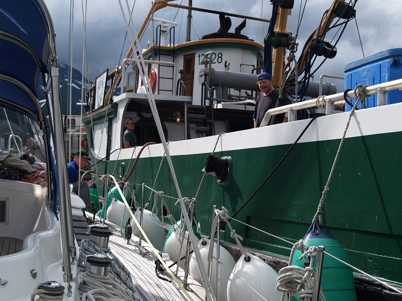
We needed fuel. There is a fuel dock in Cordova but unlike all the other fuel docks we have met with this one does not float. With 12-14 feet of water moving in and out of the harbor twice a day at low tide the fuel dock towered above us. I went over in the dinghy to check it out and saw the dock is built on creosote-soaked pilings that stick out in an irregular fashion. This is fine for fishing boats, many of which are metal, to crash into when they tie up to get fuel. It won’t work for us and an alternative method needed to be found.
Kim, who knows everyone, called in a favor with the cannery she sells fish to and they agreed to let us use their tender to fuel up. M/V “Saturn” happened to be two boats behind us on the dock and we happily backed down to tie up alongside. The guys on board were great and even the dog took an interest in what was going on as can be seen from the photo below:
According to longtime residents, the summer weather so far in Alaska this year had been the best in living memory but as we readied for our next passage of 500 miles back out into the Gulf of Alaska it started to change. Of course, the change was not for the better.
We left Cordova and anchored in Sheep Bay 22 miles away in 63 feet in a spot called Mud Bay (N 60 39.645, W 145 58.249) hoping for a break in the rain. This was the northernmost point of our trip and it was neat to cross 60 degrees north. After two days there watching the rain and fog chase each other around the boat we decided to move to Garden Cove, Port Etches on Hinchinbrook Island, a protected anchorage that is just off on the gulf in 58 feet (N 60 20.198, W 146 32.789). This would make it easier to depart once the weather cleared. If the weather cleared.
And she blows 54 knots
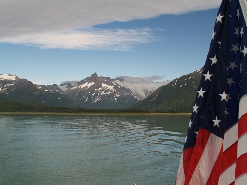
Looking at my logbook now I see winds that day were a steady 35-45 knots with three foot following seas. We sailed most of the 40 miles relying on just a scrap of foresail and no main at 7.5 to 8 knots SOG. The highest gust we saw that day was 54.9 knots. My ensign, the big American flag that hangs off the back of the boat, took a real beating, snapping tightly in that wind.
Another note from my log after we anchored and waited two more days for the rain to stop. It seems I was getting philosophical:
“Most people it seems spend their lives ‘existing’ rather than living. How you define the difference between the two says a lot about who you are. Another turdlet of wisdom.”
On the afternoon before our departure the rain stopped and we took the girls ashore for the first time in almost a week. They were happy to look for shells and eat salmon berries while I looked for bears and watched salmon jump out of the water. I saw huge schools of fish amassing below the little brook we were standing next to. I thought I saw the bottom of the bay but it was an enormous school of humpies that kept undulating and changing color as the fish moved around. Quite a few of them were trying to make their way up the brook and I called the girls over to watch this natural spectacle.
We wandered into the brook and caught a few with our hands. It was great fun.
The mornings come later and later now with the sun rising at 6:30 am instead of 4:15 am. The seasons are advancing and I get up now long before it is light. The night was calm and as the dawn beckons we see sunshine. It is time to go. Our passage south actually turned out pretty well. As always, we had wind from all points of the compass but were able to do some sailing instead of just motoring the whole way. After 451 miles we decide to pull into one of the many coves that indent Baranof Island and get a good night’s sleep. I press on as far as the light will allow and then dart in to Mussel Point Cove and anchor in a mill pond where the only sound is that of fish jumping. (N 56 19.426, W 134 51.250, 63 feet).
Up early the next morning we motored all day in the rain to arrive in Craig, covering 85 miles in 11 hours. We tied up to the transient dock on the south side of the town and spent two days there doing laundry and provisioning. And watching the rain come down accompanied with 20 knots of SE wind.
Craig is a funny place, named after Craig Millar who opened a cannery here 100 years ago. According to the locals, the town is dying. It is a small place and easy to walk around. We took a taxi to do laundry – always high on our list of things to get done when we hit shore. We went first thing in the morning when the laundromat opened and aside from an old logger we were the only people there.
A view on coin laundries
Having used coin laundries up and down the coasts and islands of Alaska and many other places in the US, I have noticed a few things. First, as unglamorous as they are nothing beats the convenience. Secondly, the people who habitually frequent laundromats seem to share a couple of characteristics: they like to sleep in and they all smoke. I am not a fan of either habit and am glad the girls are early risers. Asmara, more by nature, and Adriana just because she doesn’t want to miss out on any of the action. Sleeping in late is the goal of underachievers everywhere.
Our hopes of heading south offshore and making time are dashed by the weather. Just as when we wanted to head offshore and go north we were met by unseasonable northwesterlies, now when we want to head south we are facing unseasonable southeasterlies. Such is the cruisers lot!
Craig puts us back on the inside and out of the Gulf. This gives us a little more control over our destiny regarding the weather. After three days of rain and 20 knots of wind in Craig, I say “Screw it. It’s time to go.”
In the rain and wind we head south and work our way through Tlevak Narrows where our speed went from 7 knots to 1.8! Called “Skookum Chuck” by the locals, we were against it and the water looked like a white staircase of rapids and whirlpools as we forced our way forward. We spent a quiet night in Klakas Inlet in 40 feet of water (N 54 54.000 – really, W 132 22.614).
A fast 100 mile passage across rolly and rambunctious Dixon Entrance was ahead. Named for George Dixon, an English sea captain and once a petty office on Cook’s last expedition. Dixon later ran the trading vessel, the Queen Charlotte up and down the coast for a few years and named that island group, home of the fierce Haidas, after his ship.
We arrived back into Prince Rupert, Canada, 150 miles south of Craig and the first place we have returned to on this trek. We had just crossed our outbound track and the log tells me we have sailed, motor sailed, motored and just willed the boat forward 3,244 miles so far. We again spent the night at the grandly named “Prince Rupert Rowing & Yacht Club.” Reality is less generous.
Deadheads – nothing to do with Jerry Garcia
The crack of dawn sees TGS “Asmara Sky” heading south again. The waters of Canada are FULL of fiberglass-munching logs and even a few deadheads. Rare in Alaskan waters or those of Washington, deadheads are logs which float perpendicular with just a foot, or sometimes less, bobbing menacingly above the water. I feel one should subscribe to the “cockroach theory” when it comes to deadheads and corrupt politicians: when you see one, there’s more. The water around Prince Rupert was an absolute minefield of lumber which caused us to zig and then zag and then zig some more all the way out. It is said, “The US means business.” I think to myself for sailors at least, “Canada means logs.”
The next several days are tiring as I motor from dawn to dark everyday doing my best to overcome fatigue and the curious magnetic attraction between fiberglass and floating trees. One morning we are passed by a powerboat doing 15 knots with the name, “Beauty, Eh?” He waved as we flew by on his happy journey. I laughed and returned the friendly gesture.
Our first anchorage after leaving PR was Tuwartz Bay on Pitt Island. We had decided to take the “outside inside” route back rather than go the way we came using Grenville Channel. I do NOT recommend Tuwartz Bay. The water is deep (70 – 120 feet) and the bottom is smooth rock. We anchored FIVE TIMES in two different spots as it was getting dark before I got the anchor to stick. It was a nightmare and after letting out 280 feet of chain (twice) and pulling it up (twice), the windlass overheated and just quit. Fun.
Neat trick
I finally got desperate and set the hook by motoring ahead at 2 knots, shifting the engine into neutral and then dumping the anchor. A neat trick I have had to use only rarely in the past.
We traveled 91 miles that day and anchor in 70 feet after two hours of effort (N 53 18.457, W 129 31.103). Again NOT RECOMMENDED. Avoid.
We enjoyed the company of 8-10 whales feeding in Laredo Channel the next morning. They were not humpbacks but perhaps minke? I took many photos. The fluid grace of these hugely powerful animals is evident as their glossy massive mermaid tales curve up out of the calm water. Following a lazy arc the tale glides further up and with unbroken motion sinks down below the surface with nary a ripple. Sublime creatures.
Asmara pops up the ladder into the cockpit. “Look, Daddy! I lost my tooth!” A wobbly tooth that has been very stubborn all summer long has finally come out. I promise her the Canadian tooth fairy will find her.
We motored 86 miles in overcast conditions and anchor in Berry Inlet on our second try, just 10 miles west of Bella Bella in 50 feet of water. (N 53 16.483, W 128 19.364).
That morning we head to Bella Bella to fuel up. I have trouble finding the fuel dock as it is not marked and the city dock is tiny and crowded with large fishing boats. I hail another sailboat I see leaving on VHF and he recommends the Shearwater Resort just two miles away. We pull up there and get our fuel and water. My watermaker is kaput and we need to keep an eye on consumption a little more carefully now.
That night we spent a very quiet night in Green Island anchorage, Fish Egg Inlet in 33 feet, travelling 58 miles. (N 51 38.531, W 127 50.192). The notes from my log express my thoughts at that moment:
“Early morning all is still and quiet. The water is glass reflecting perfectly the trees and rocks on the shore upon its mirror-like surface. A couple of old and bumpy logs have drifted into the anchorage, half submerged they look like Nile crocodiles quietly eyeing us. Everyone sleeps and as I read down below I can hear the powerful exhalations of a whale feeding in the sound just beyond the little islands and screen of green spruce that separate us. Magic.”
A rough Queen Charlotte Strait stood between us and Vancouver Island. The weather forecasts put out by Environment Canada were grim listening: “Wind SE 25-35 knots….” Southeast was, of course, our direction of travel. Like salmon collecting before the stream, we along with quite a few other boats heading south before the season ended, were waiting several days for the right weather to continue. After wasting 4-5 days of just hanging around, I said, “Screw it. Let’s go.” Again.
Singapore: the Canada of Asia
The crossing was easy. Despite dire forecasts, as Ariel put it, “You couldn’t ask for calmer conditions.” Having gone to university there, I noted Canada is a conservative country. They are conservative in manners, speech and dress. I just wish they didn’t extend their radical conservatism to weather forecasting. Ariel opined then that would make Singapore the Canada of Asia. With the exceptions that Singaporeans can’t drink, are bad at sports and hate the outdoors, I totally agree.
We spent the night at Port McNeill Fuel Dock and Marina again. My log just notes: “Laundry. Shopping. Dinner.” Yep, that about sums it up.
The continuing voyage south was almost uneventful. The logs, kelp and debris in the water are much less after crossing Queen Charlotte Strait going south. In the Strait of Georgia the forecast finally eventuated accurately and in the afternoon we ended up with wind 25-30 on the nose increasing to 30-35 knots. This created sharp, steep waves which we powered into sending heavy slabs of thick green water all over the deck. Our 7 knot progress dropped to half that and we peeled off to anchor in the well-named Deep Bay. As we headed off the straits to seek shelter the true wind speed built to 40 knots with the highest gust reading 45 knots true. We spent a rainy, blowy night there but the wind never exceeded 20 knots in the anchorage. As a result, we only managed 62 miles that day.
The next day once we passed through Dodd Narrows (always a thrill since it is only about two boat lengths wide) we entered a totally different world of the calm, flat warm water of the Gulf Islands. The sun shone brightly and I had to remove my four to five layers of clothing and even my boots and wool socks. Barefoot motorsailing down the Trincomali Channel. What a change.
Of course, this comes with a price. Boats are everywhere and the anchorages are crowded with people in a hurry. Civilization: I’m not sure it’s a good idea.
There was so much radio traffic with silly boat names. I couldn’t resist so I put out a call of my own:
“Bilge Pump, Bilge Pump, Viagra 2, Viagra 2, over.”
A shocked silence seemed to hit the airwaves for a minute or two. Ariel glared at me. Then the chatter started right up again.
We anchored in a jam-packed Montague Harbour on Galiano Island in 61 feet. (N 48 53.323, W 123 23.953). It was a beautiful summer’s evening and a totally different world from where we had just come.
Two days hence, after checking back into the US at Roche Harbor, we arrived safe and sound back to our slip in Shilshole Marina, Seattle on September 1st, exactly three months after we had left. We had sailed almost 4,000 miles over the last ninety days and saw incredible wildlife, stunning natural beauty, met interesting people and spent quite a lot of good “quality family time” together.

The boat and the crew handsomely lived up to the challenges that were presented to them over the summer. How I love them both.