- Boat
- Articles
- About
- Tehani-li Logs
- 2004
- Uligan Maldives
- Man, Oh Man, Oman
- Eritrea: The Nicest Place You’ve Never Heard Of
- Cruising Notes: Oman to Eritrea – From Pirates to Cappucinos
- Old Testament Sudan
- Egypt: Legend, Myth and Reality
- Thoughts on Cruising the Red Sea
- Greece: Civilization Again
- Montenegro
- Malta
- Sardinia, Italy
- Barcelona, Spain
- 2003
- 2002
- 2001
- 2004
- Contact
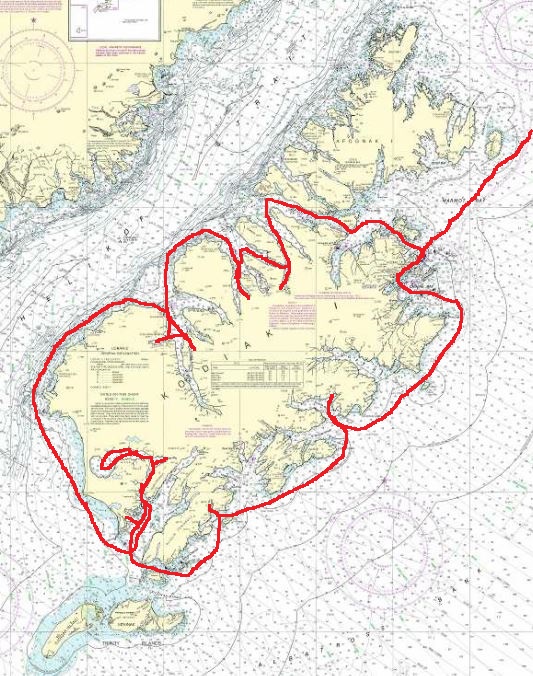
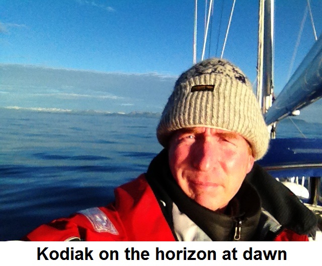
Kodiak Island Circumnavigation
We wanted to go to Kodiak but thus far we had only made it to Sitka. To get to Kodiak we needed to cross the feared Gulf of Alaska. It was critical we picked the right weather window to make our first crossing of the Gulf of Alaska. In the middle of the gulf where we must go seas reach 30 feet and sometimes 50 feet in height if the weather turns evil. We wanted to avoid that. Every day for several weeks I studiously downloaded the latest weather forecasts via our Iridium satellite phone. The information is presented in grib file format which using wind arrows show the forecasters’ best guess of wind direction and strength. I hoped that by constant exposure to this information I would begin to get a sense of how it all fit together and be able to make the right decision. It turned out the forecast that I decided was our green light to go was 100% accurate as to wind direction, speed and when it would shift. We would also find at the end of the season the opposite to be true in Canada.
Imaq: Ocean
Always a believer in early departure, I fired up the Yanmar 4JH3-HTE and we pulled out of Sitka quietly at 4:30 AM. The weather was foggy and drizzly and we quickly lost sight of land, rocking and rolling with the swell as we crept westward at 7.5 knots motorsailing.
Navigating the old fashioned way by GPS, I saw at noon we had put 53 miles between us and Sitka. I shared the good news with Ariel: only 498 more miles to go! She was distinctly unimpressed and not looking too happy either. Asmara and Adriana spent their time dozing in the cockpit and only woke up to periodically lean over the side and share their breakfast with the fish.
I spotted a pod of Orcas, our first sighting. They approached the boat from behind as we motor sailed at a respectable 7.5 knots. Their dramatic obsidian black dorsal fins, some up to six feet high, pierced the surface of the gray water and menacingly rose like a saw blade coming up through the floor. They passed us as if we were standing still. I pointed out a baby orca and its mother to Asmara. There was no other traffic, just us and them out here, now 62 miles offshore and land a distant memory.
By the next evening we had tickled our way halfway across the belly of the gulf. The weather was still overcast with periods of rain and the winds were variable which required us to listen to the motor endlessly drone on and on like some professors I have known. I kept the sails up, a combination known as motor sailing which gives us a little lift and allows us to eat up the miles at 8 knots per hour. Asmara and Adriana completely recovered from yesterday’s seasickness and were their normal bouncy and cheerful selves. Their mother had not and was not. I took a hot shower despite the conditions which required some balance and gymnastics as the boat heaved and rolled, heaved and rolled. Ariel wouldn’t go downstairs and spent her time bundled up in the cockpit staring out at the horizon probably thinking of trees and flat land, I wonder. Braced between the galley sink and stove I make a hot dinner for everyone.
The winds picked up at night as so often is the case on passage and we had 20 knot cold blasts blowing astern making it rougher and “rolly-er.” Wearing six or seven layers of clothing, wool gloves and a wool hat, I pulled my second all-nighter in a row in the cockpit navigating, steering via the autopilot and watching for any errant ships out here. We see nobody. Even the whales have disappeared. It was just us in our bouncing home tiptoeing our way across the face of the vast ocean. By morning we had completed 383 miles and had only 169 to go.
By the evening of the second day just 100 miles separated us from Kodiak. This was also the patch of water where the monster waves lurk, I kept thinking to myself. The winds backed to the northwest as forecast and the seas thankfully flattened down. Even the clouds seemed to have moved on as the sun shined weakly down as if encouraging us to continue forward on this crazy journey. We saw more bird life now that we were within striking distance of land. With calmer conditions all aboard had hot showers and crew morale improved remarkably. We enjoyed a stunning sunset – at 11:15 PM! Ariel retired down below to sleep for the first time and as darkness came on again I spent my third night in the cockpit. I could see a blue and yellow glow above the horizon where the sun had disappeared. It never got really dark and this glow stayed all night until at 0500 when the sun popped up again happy to see us.
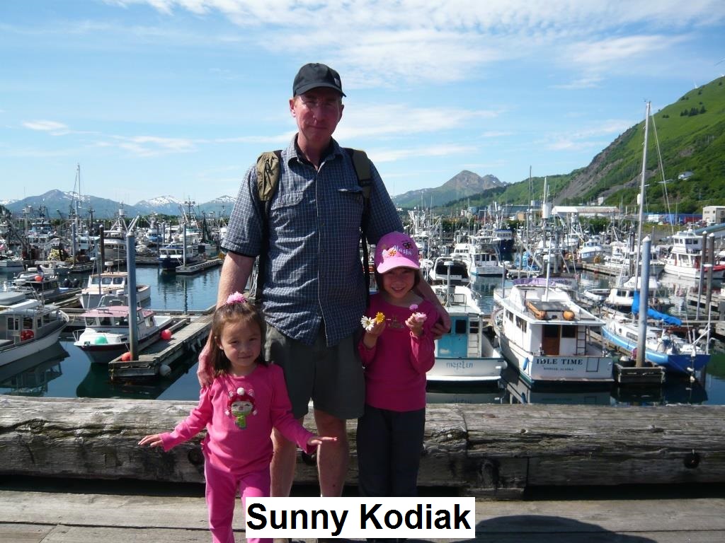
We arrived in Kodiak town at 0830 to a beautiful sunny day. Total passage distance: 575 nautical miles covered in 75.5 hours at an average speed of 7.6 knots. I slept a total of four hours. It was a tolerable effort.
We called “Kodiak Harbormaster” on channel 16 as we approached “G3” in the northern channel and arranged for a berth. We like to fuel up right after a passage before tying up as it allows us to get that of the way and get an early departure when we want to leave without being left to the mercies of erratic fuel dock operators. The Kodiak Petro Marine fuel dock is in the narrow channel between Near Island and Kodiak just past the high bridge. I put in 130 gallons at $3.98 a gallon. It was easy and, aside from the cost, painless.
After tying up the boat in the harbor, plugging in and making sure everyone on board was settled, I grabbed the trash and walked up to the Harbormaster’s Office to check in. I had heard of Marty Owen, the Harbormaster, and was keen to meet him and say hello. We kept missing each other for the first two days we were there but on the third day I found him in his office. He was a kindly man and a hive of activity.
I introduced myself, sat down and explained how I once worked on a boat here.
“Really? Which one?”
“The Dawn Mist. Have you heard of it?”
He laughed, “Dawn Mist? Sure, I know it. Jim and Diedee, right?”
“Yes, that’s right. Do you know them too?”
“Diedee is my aunt!” he answered, “She lives right up the hill there in that blue house,” he said pointing out his window.
Marty grabbed his cellphone and said, “I’m going to call Diedee right now.”
“Uh,” I was a little startled, “I don’t know if she’ll remember who I am, Marty. It was a long time ago.”
He was already on the phone, “Diedee, how are you? I got a fella here says he worked for you in Uganik.” He put his hand over the phone and asked for my name again.
“Yeah, Derek Hillen.”
Pause.
“She wants to talk to you,” he said handing over the phone.
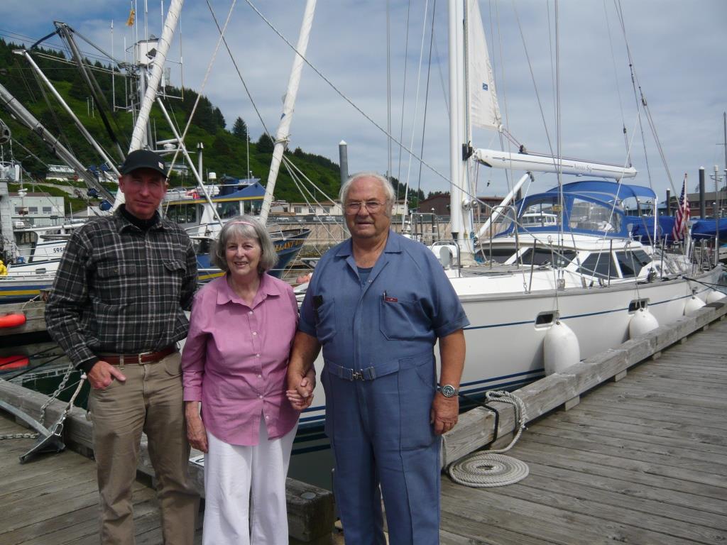
Diedee, it turned out, remembered exactly who I was, where I came from and some of my old stories too. She was always very sharp and I guess I shouldn’t have been surprised. We arranged to meet for lunch at Henry’s the next day and she would bring Jim.
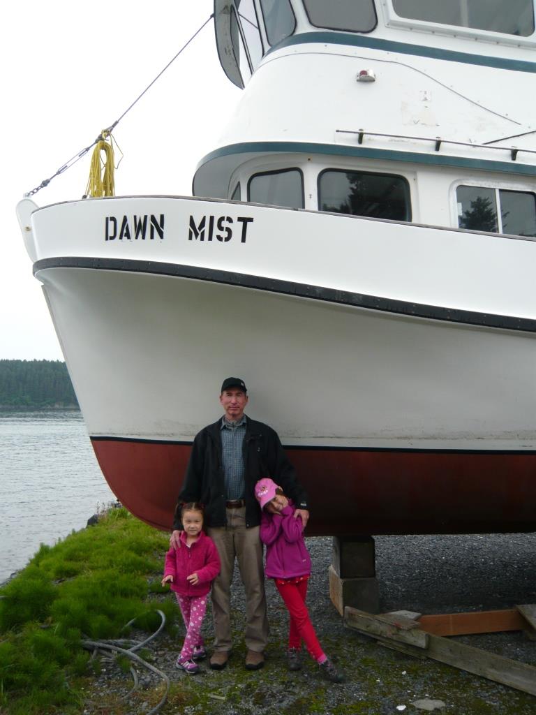
We met as scheduled at Henry’s, the lunch/bar TGIF place in town, which is right across the street from the harbor. Also, note: there are no “marinas” in Alaska. Only “harbors.” Marina, as a word, implies posh facilities, yacht clubs, posers putting on airs and such things that Alaskans despise.
Jim and Diedee had aged since I last saw them but then hey, so had I; showing up with a wife and two children in tow. After an enjoyable lunch spent catching up I was keen to show them the boat. We walked down to the dock but Diedee was too frail to climb aboard and waited patiently outside while I gave Jim, a lifelong fisherman, the grand tour. He seemed really impressed with the watermaker (which doesn’t work) and wanted to know why my 200 gallon fuel tank was so small!
While in the harbor we were befriended by Kodiak residents Tom and Lara who own a sailboat in the harbor. They came over and said hello and invited us to their house for a BBQ. It was enjoyable to meet people who lived on the island year round. While originally from Wyoming they both loved the outdoors and enjoyed all Kodiak had to offer. Tom was helpful with giving me ideas of anchorages in the northern half of the island as well.
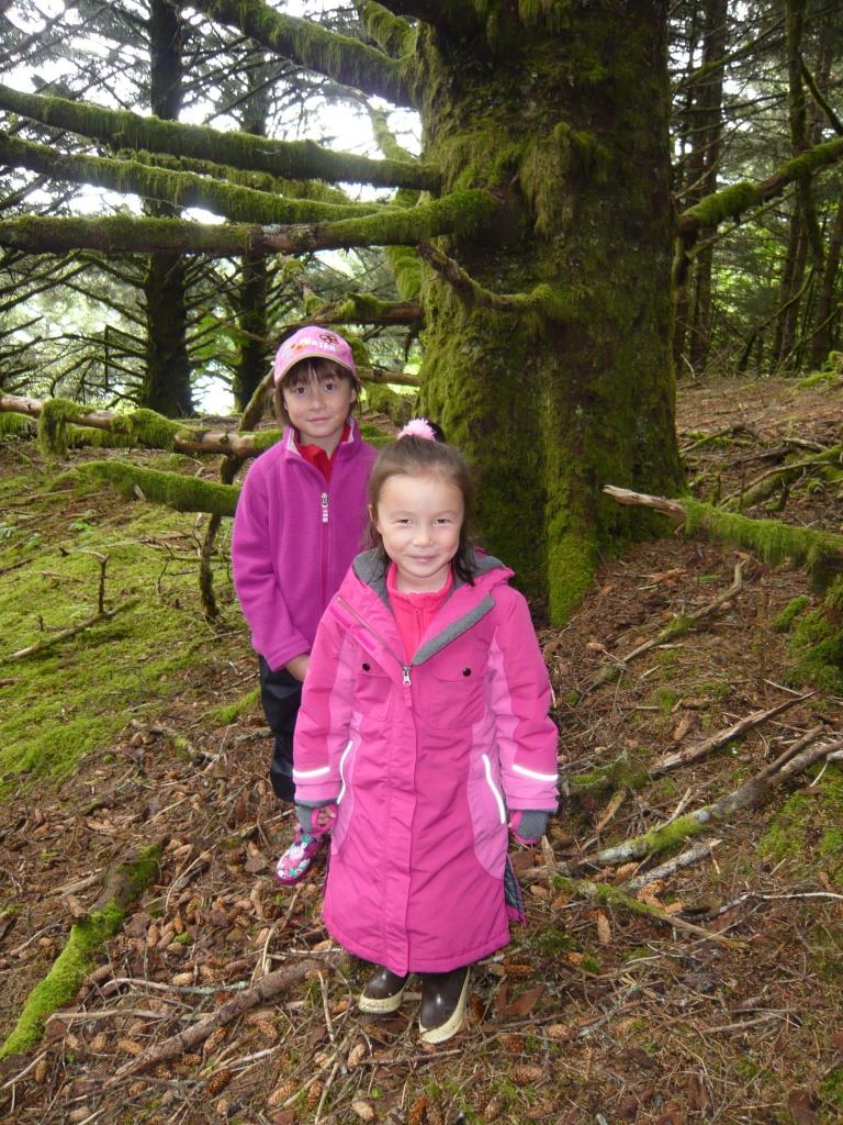
All told we spent a week in Kodiak. We occupied ourselves with provisioning, routine maintenance and doing laundry. We also rented a car for several days which was an expensive $100 a day. I think next time going by taxi would be much more cost effective. There aren’t many roads on the island but we did want to get out and see what we could. We drove out past the space launch (yes!) and found these animals blocking the road:
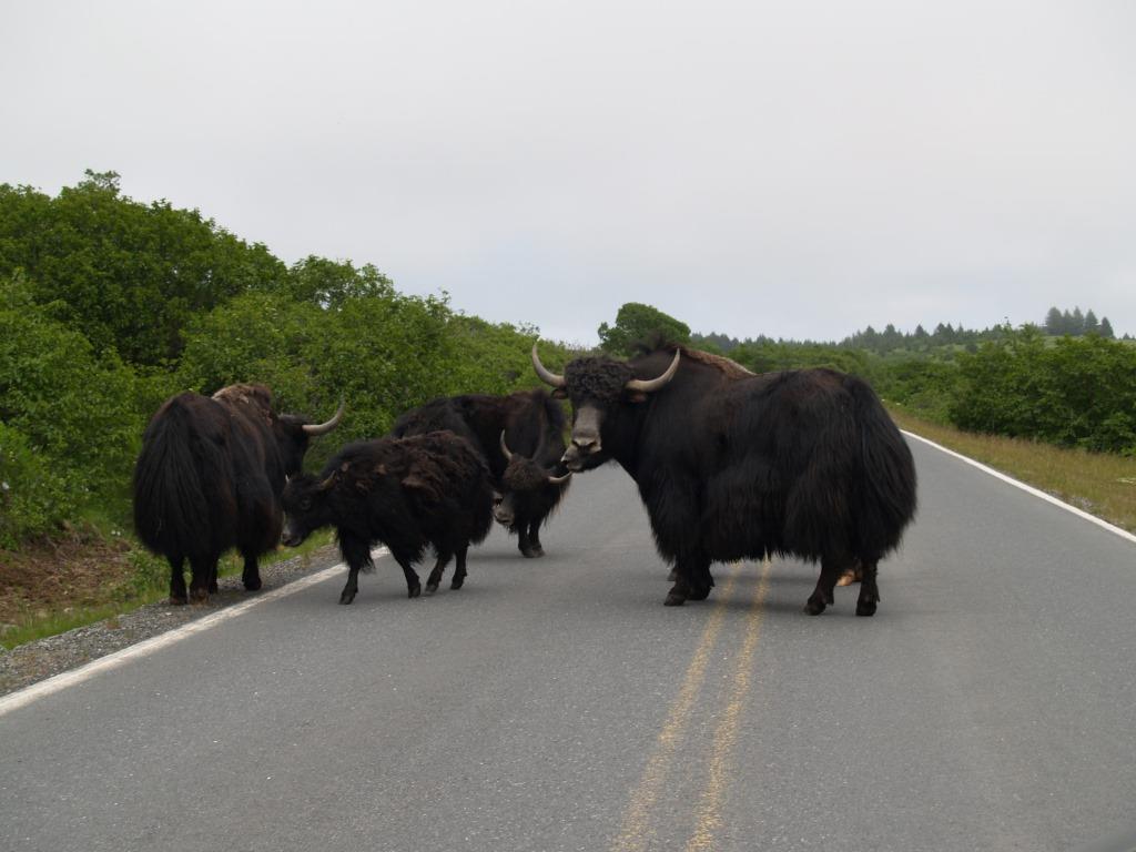
Yaks running wild on Kodiak in the bear refuge? It seems somebody brought them over and raises them for meat. I hadn’t seen a yak since I was in Qinghai and Tibet 30 years ago. They do taste good.
We also saw these just down the road from the yak pack:
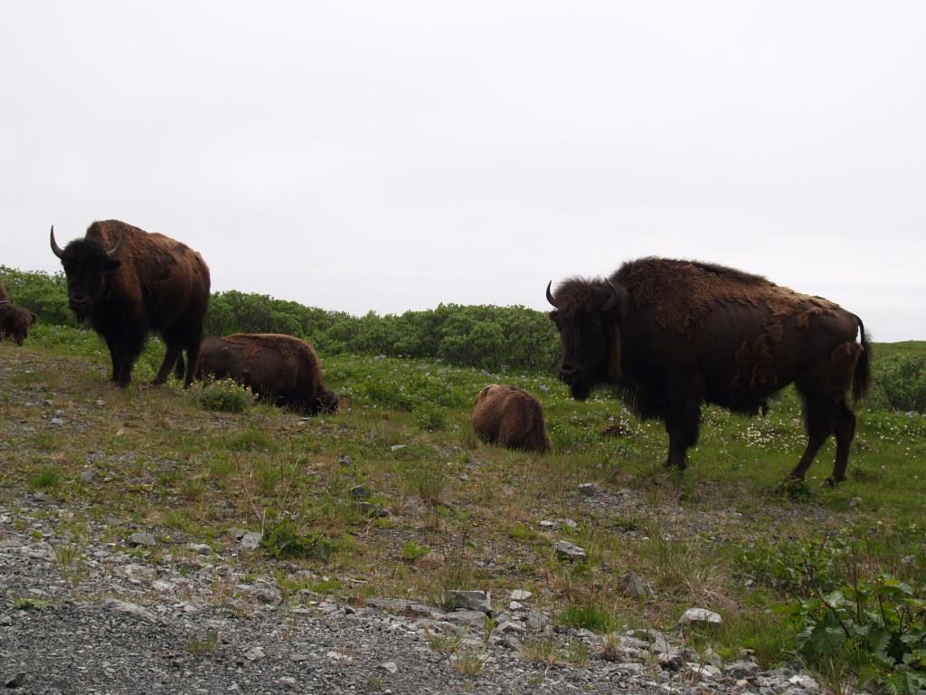
I think they were brought to the island by the same rancher. These bison roam around and do quite well here. Cattle herding was tried here back after the war but predictably the bears ate all the cattle. Yaks and bison are a bit better prepared to deal with the threat than your docile fat bovine.
Our original plan in coming to Kodiak was to see Jim and Diedee and then sail over to Uganik Bay. After that we were going to go to the Alaska Peninsula and then meet friends in Homer.
“Screw all that,” I told Ariel.
“What do you mean?” she asked.
“Kodiak is so awesome we should spend more time here. Let’s circumnavigate the island!”
And we did. And it was awesome.
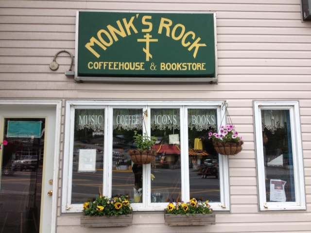
We said our goodbyes to the town of Kodiak and the great sandwiches at “Monk’s Rock” around the corner from the harbor. It seems to be run by the Russian Orthodox Church and everyone there is….mellow. They sell music, coffee and icons, of course.
One warning to cruisers: do not use electricity in St. Paul Harbor. We were charged a $25 “connection fee” AND a $25 “disconnection fee.” We are a sailboat and hardly used any power while at the dock and these fees I felt were exorbitant and annoying. I complained to Marty, the Harbormaster. He explained that they charge this because we use someone else’s power at their slip and the office has to calculate what they used and what we used and then reimburse them. I haven’t found any other harbors that have the same problem. We did not plug in when we returned to St. Paul Harbor at the end of our island circumnavigation.
Arhnaq: Sea Otter
We timed the tides to make it through Whale Passage with no stress and saw rafts of sea otters as we entered Kupreanof Strait. I noticed on the chart, “Last Timber Point” to starboard as we passed into the strait. It was true, there were no more trees from then onward as the southern half of the island resembles the Aleutians in green, treeless splendor. Our circumnavigation of the island was going to be counter clockwise and our first anchorage was “Terror Bay,” a name to give one pause. To get there we motored softly down beautiful Uganik East Passage and anchored at the end in terrible Terror Bay where the water began to shallow in 30 feet (N 57 43.947 W 153 13.143). A nice mud bottom meant the anchor stuck like glue and I slept like a rock.
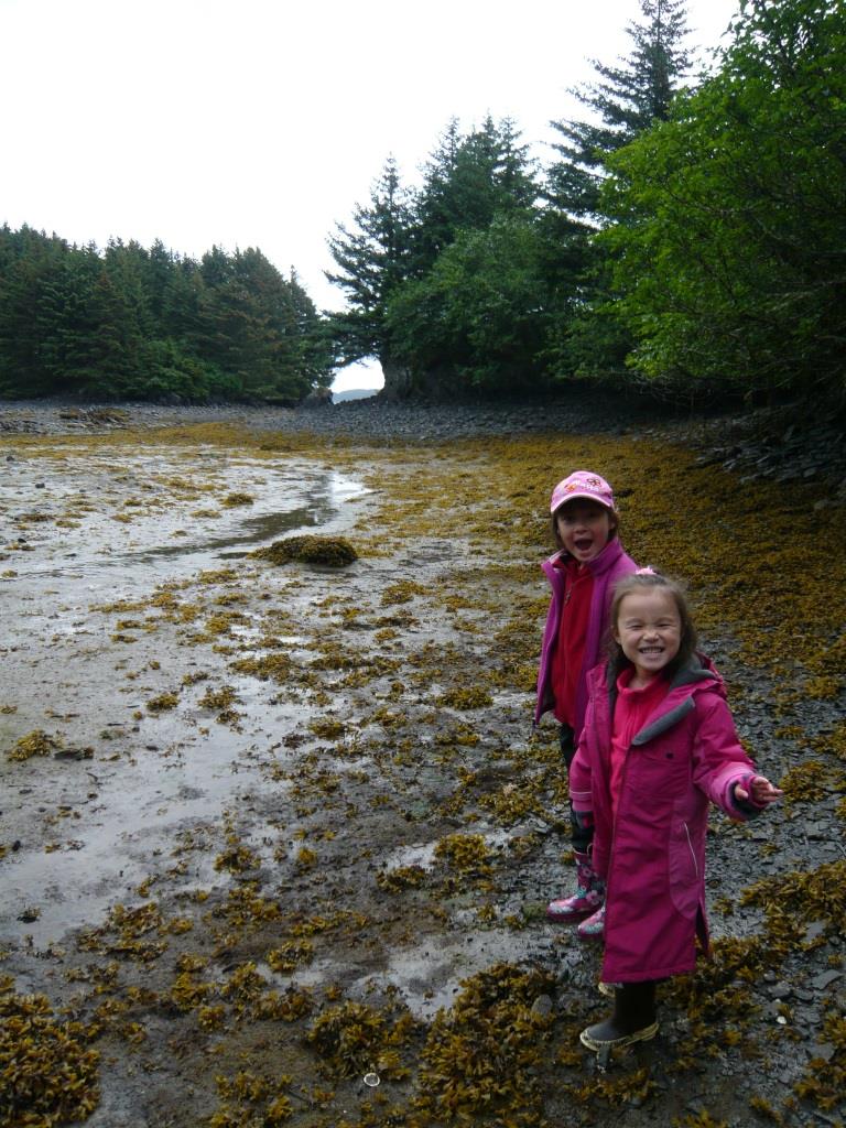
We were fortunate Terror Bay for us did not live up to its name. It was just very nice and this was the first place we went ashore on our own. I had just installed new Simpson davits and got a new dinghy and was keen to try both out. After some playing around with it I was able to lower and raise the dingy with no issues. The next step was to decide where to beach the dingy and use our elastic “Dinghy Buddy.” This is a stern anchor on 30 feet of line with some elastic. The idea is you toss it out behind you as you get close to the beach and step off the dinghy with another anchor and a longer line in hand. That way the dingy is pulled back off the beach into safe water. You put the other bigger anchor down into the beach so you can pull the dinghy back up to you when you are ready to leave. It took some practice but worked very well for us the whole summer.
The other thing to keep in mind is the state of the tide. When ashore I always kept an eye on the dinghy and either let more anchor line out or pulled it in if the tide was falling or rising. It is amazing how quickly those tides move up and down the beach.
There was not a soul around and we spent a blissfully quiet night on the hook listening to birdsong until late when the sun finally turned in, around 11:00 PM! I kept scanning the horizon for bears but we didn’t see any. Mid June is a little early to see bears on the beach as the salmon aren’t really running up the streams yet.
The next day we passed through rock-strewn Uganik Passage and watched seals sleeping on island beaches as we made our way to Uganik Bay, where I worked that summer ages ago. We anchored in another very protected spot, what the locals call “Mush Bay,” but is called “East Arm” on the chart in 34 feet, mud (N 57 42.397 W153 28.072).
Taquka’aq: Bear
Taking the dingy ashore and playing around with both anchors I finally got the family safely on the beach. We walked for about half a mile when I spotted a huge mama bear and two massive cubs coming through the tall grass about half a mile ahead of us. I whipped out the binoculars to be sure. Yep, three bears. Big ones, wow, the cubs are my size. I looked over at the girls laughing and collecting shells at the water’s edge. My gaze then searched for the dinghy down at the end of the beach. We were exactly midpoint between the bears who can run as fast as a horse and the safety of the dinghy.
“Right. Girls, time to go back.”
“But Daddy, we just got here!”
I handed the binocs to Ariel and then Asmara and all agreed it was time to vacate.
We really felt a surge of adrenalin seeing those big beautiful animals on their turf with nothing between us except some air. It is always a bit of a shock to be suddenly displaced from the top of the food chain but that shock I think is good for us.
We walked carefully and not too fast back to the dinghy with me playing “tail gunner” and watching the bears amble in our general direction. Due to the breeze they hadn’t senses our presence yet. We made it back safely and rode the dinghy 5 miles across the bay to the old fish camp where I had worked. (I wrote more about this and the crazy end of a crazy loon named “Coyote” in the previous post).
The next day we continued our tour around the island and motorsailed 50 miles to anchor across from Larsen Bay in a place behind Amook Island the locals call “Brown’s Lagoon” (N 57 31.245 W 153 48.938) om 35 feet. It was a beautiful secluded spot with tall green mountains on one side that had thread-like waterfalls tumbling down from impossible heights and grassy hills on the other. We took the dinghy further into the anchorage where a small river appeared which we followed up to a small waterfall. As with everything in Kodiak, it was unspoiled and stunningly beautiful. The water was crystal clear and we had the place to ourselves.
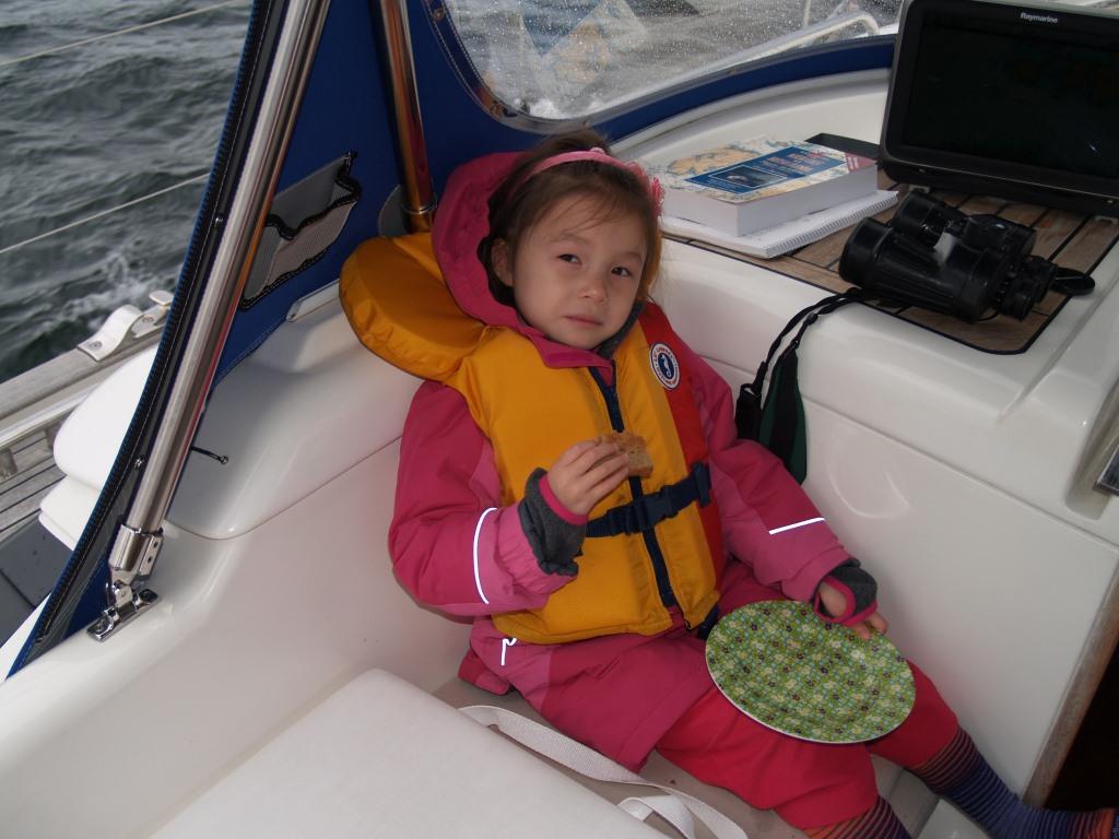
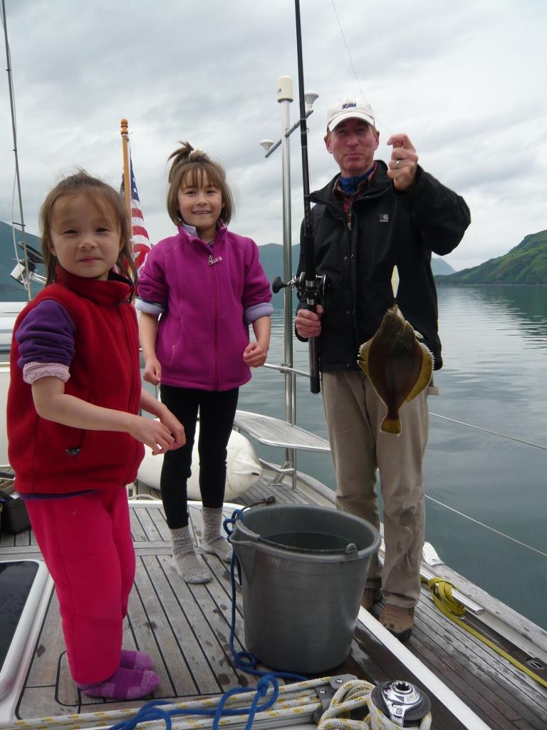
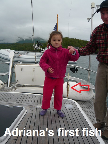
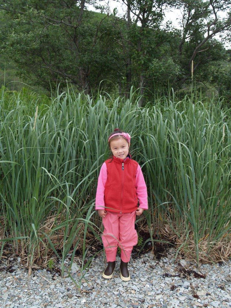
That evening after a day of beach combing and shell collecting I tried fishing off the back of our boat with Asmara and Adriana. They were clad in pink pajamas and their big puffy yellow life jackets. In Sitka I had purchased two toy fishing rods for them; one purple and the other pink. I taught them how to patiently jig for fish; let the lure out a ways, reel it in a little bit and the lift the rod up high to the sky and let it sink back down. Rinse and repeat. We caught several small pollock. Adriana, the little one, actually caught her first fish there and was pretty excited. It was another small pollock about 8 inches in length. After taking some pictures we let it go and got back to some more jigging.
But we didn’t catch any more fish.
“I guess all the small fish we have let go have told the big fish not to bite our lure,” I told the girls.
Asmara, all of seven years old, answered me right away, “I don’t think so Daddy because their mouths probably hurt too much.”
I smiled and gave her a big kiss.
Quyanaa: Thank You
Looking up in the distance I noticed an old fishing boat cruising slowly toward us. It was a salmon seiner, bigger than the one I had worked on and after some hesitation “F/V Dreamer” pulled up beside us. On board I saw a rough looking crew of several younger, muscular guys on deck with beards and torn clothing and a wild-eyed, unshaven skipper who looked to be approaching his sixties steering the ship, a real man of the sea type.
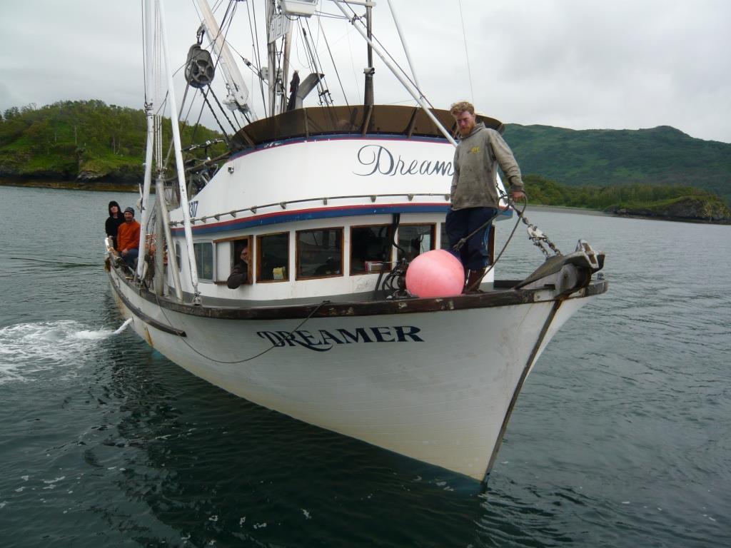
Since there are no pirates in this part of the world (although these guys sure looked the part), I took the initiative.
“Hey, there! How are you doing?” I ask.
The skipper leans out the window of the doghouse of his boat.
“Hey.” He says gruffly. “I wasn’t gonna stop until I saw your two little cute girls here.”
I smiled.
“You want some fish?” he asks.
They proceed to carve us a huge portion of my favorite salmon, bag it and hand it over fresh as fresh can be.
“So what are you doing here?” he asks.
Briefly I tell him our story and how we are circumnavigating Kodiak Island.
“Wow! I’ve always wanted to do that,” he thumped the wheel with his fist.
This would become a common theme among the people we would meet along the way. The irony of living in Alaska is you don’t get to see it when the weather is nice. This is because the weather is nice (and only sometimes) in summer and summer is peak season for every economic activity aside from skiing. And you don’t get to see it – or anything – when the weather is bad. In short, if you want to see Alaska, I have learned, don’t live there.
“Have you ever been into Olga Bay?” I ask him, hoping for information about this upcoming mysterious and seldom visited spot.
“Haven’t been there since I was a kid.”
An attractive younger woman appears, maybe the guy’s daughter? I think.
“Here,” she says leaning across to our boat and handing me a book and a CD. “Dave’s a poet. He wrote this.”
Puzzled, I thank her and take the book and CD wishing we had something to give them in return. Ariel has come up and I ask her quietly to go get something. She returns with a large bar of organic chocolate, “Sorry! It’s all we have,” she explains and they happily take it.
Thanking them profusely the fierce crew smiled and waved as they pulled away. I watched the boat anchor quietly further up the bay so as to give us privacy. When we left at first light the next day “F/V Dreamer” (what a name for a poet’s boat!) was out there prowling around, lights on and looking for fish.

That night after putting the girls in their bunks I retired to our aft cabin to have a look at this mystery book of poetry, “Another Look” handed to me boat to boat, man to man in this wilderness. Here are a few excerpts from the poem “Tattered Angel/Preacher’s Son.”
“Born, a rebel, raising hell
Direction derived from what not to do.
Best way to send me down a road,
Just tell me that way was taboo…
Long before my twenty-first,
Honky-tonks and alcohol, exerted a mighty draw.
A dancer stripping on a stage
Was the finest thing I ever saw!
Now for many years I’ve reigned in for other’s sake,
But a sense of Time spinning by too fast,
Had me asking what’s really real,
Cause nothing has ever seemed to last.
May be snow on the mountain
But the volcano still has some fire,
And if I said the Kid was gone,
I’d be a total liar!”
Dave Densmore writes a lot about his lifelong work as a fisherman using colorful natural imagery and earthy humor but also a touch of sadness lies deep inside making many of his poems quite moving.
His description of something all sailors can relate to is beautifully expressed in this poem called rightly enough, “Wind.”
“Wind is my nemesis,
Ocean is my home.
Seems I always seek big water,
No matter where I roam….
You know we get along just fine,
Mother ocean and me.
But sometimes I just get caught,
Between battling wind and sea…
No, wind is not a friend of mine,
No matter that his spirit’s free.
See, he’s always trying to crash this love affair,
Between Ocean and me.
But as I watch him caress her softly,
Bringing soft ripples to her skin,
I suspect that I’m the interloper here,
And she really belongs to him.”
I close the book and think to myself, where else can you find stunning unspoiled empty anchorages where people give you fresh fish – and poetry! Only in Alaska.
Iqallugsurta: Fisherman
The next day saw us going on the outside of the island again, heading south into the seas and wind of Shelikof Strait. It rained almost continuously while wind and wave came from all directions making it a little lumpy which meant I got to do all the cooking again. We motored until almost dark and clocked 99 miles. It was a long day and we must have set some record by rounding seven different capes: Cape Uyak, Cape Karluk, Cape Grant, Middle Cape, Cape Ikolik, Low Cape and Cape Alitak. This actually took us in a 360 degree circle and put us just a few miles south of where we started. We anchored gratefully that evening in 53 feet of water in fog and rain using radar as we entered Moser Bay in almost zero visibility. (Snug Cove: N 56 59.533 W 154 10.194).
The fog and mist and rain persisted into the following day. We took the dingy out anyway to explore as the cloud ceiling was about 100 feet and on the water we can see quite well. Heading up to Chip Cove we went ashore to explore the abandoned cannery. Fishing used to be big business and there were dozens, if not hundreds of active cannery operations up and down the western Canadian and US coasts. One hundred years and even 50 years ago, canning was the only way to get fish from where the fish were but the people weren’t to where the people were and the fish weren’t. Improvements in refrigeration and cheaper air cargo have caused most canneries to close down and coming around a corner or into a new bay you often see on shore their rotting shells; a collapsing pier here, a wooden bunkhouse where once hundreds lived falling apart there and always rusty bits of large machinery littering the beach. These quiet skeletons of a past era are interesting to walk around and sometimes one can find old newspapers or magazines that were current in the day.
On the way back to the boat a large aluminum skiff with several men in it approached us in the wind and rain on the water. I slowed the dinghy down and let them pull up to us.
“Hello, there!” says the big bearded bear of a man at the helm of the skiff clad like the rest of them in wet orange fishing slickers and brown Xtra Tuffs.
“Hi,” I respond grabbing onto the side of their boat to stabilize the dinghy and allow us to talk bouncing up and down in the chop. “I thought I’d take the family out for a drive today….”
He laughs and introduces himself, Rick Ellingson, and his three crewmen.
“Good thing you anchored where you did, right out of the way of all the nets and things.”
“I keep an anchor light at night too just so people can see me,” I tell him.
“Yeah, that’s a good idea. I remember fishing offshore of Oregon one night back in the 70’s. Didn’t have no lights then and another boat plowed right into me and cut my boat in half.”
Yikes.
Later, once we are dried off and back aboard Asmara Sky Rick roars up again in his monster skiff.
“Say, why don’t you guys join us for dinner tonight? Our place is at the head of the bay. We’re having venison rump roast.”
Another kind offer I am happy to accept. After loading the girls up into the dinghy that evening I explained to Ariel (who grew up in New York City) that it is a fish camp we were going to, not a dinner party, so conditions may be a little “rustic.” She carried the salmon fillet we got from Dave yesterday and were planning to eat that night plus some fresh baked cookies she and the girls had made that afternoon for the occasion.
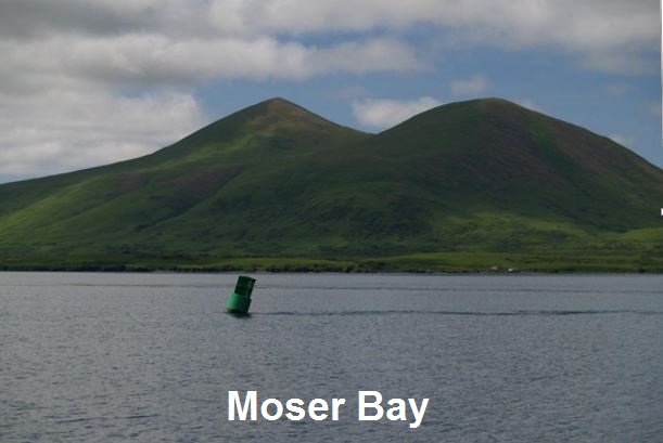
We ate like kings in the cabin with Rick and his crew, enjoying venison from a deer he had shot, the salmon we brought, piles of fresh Dungeness crab from the bay we anchored in and amazingly, tons of succulent leafy green salad. A forty-year resident and fisherman of Kodiak, Rick is quite the entrepreneur and has built two large greenhouses beside his cabin. The veggies he grows there including kale, broccoli, bak choi, carrots, etc. he sells to the cannery in Lazy Bay. Asmara and Adriana spent their time eating and playing with his young Labrador retriever, “Rosie.” Rick was a wealth of information about Kodiak in general and the surrounding area in particular much of which I marked down on the charts I had brought over.
“We got a lot of bears here on the island so you always have to keep an eye out. Right here where we are there is a sow and cubs that wander down that hill over there. She checks the stream for salmon and you can see them almost every day. For a summer I had another sow let her cubs play with my dogs in front of the house here. I had two smaller terrier dogs then, one, Jake, was kind of old and a little deaf but they got along with those cubs real well. Mother would stand off a little ways and just keep an eye on things while the cubs played and I worked outside.
You know, the only time I had a little trouble with her is when she thought Jake was playing a little rough with one of them cubs and charged him. I knew it was just a mock charge but I also knew old Jake was too old to get out of the way in time so I took off my hat and threw it right at her. Hit her on the nose and stopped her in her tracks. She looked mighty offended but backed off and that was it.”
Qik’rtaq: Island
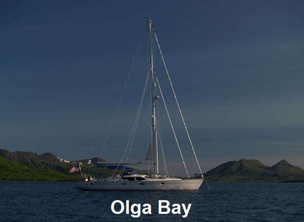
The bottom of Kodiak Island where we were safely anchored is indented by a huge, almost landlocked body of water called Olga Bay and probably named long ago by some lonely Russian sailor for his girlfriend. To get into Olga requires running the gauntlet of the winding Olga Narrows. Here is what the official government published Coast Pilot says about it:
Olga Narrows connects Moser Bay with Olga Bay. It is possible to carry about 21 feet through the passage only carefully following the narrow and crooked channel. It should not be attempted except with local knowledge. The current in the narrowest part of Olga Narrows attains an estimated velocity of 8 knots. During large tides there is no stage at which there is slack water the entire length of the narrows….
Obviously the narrows are not to be taken lightly. Our top speed under power is 8 knots which means we would be at a standstill with no ability to control the boat if we entered at the wrong time. Looking at the chart I saw many shallow areas and sandbars less than the 8 feet of water we need to float the boat. However, after talking tactics with Rick (my local knowledge), I decide we could do it.
The next day dawned, well it didn’t dawn at all; we arose to rain and fog and almost zero viz again. Getting the tides right to get through Olga Narrows in one piece required we enter the narrows at precisely the right time which was 1700 hours local time that day. We upped the hook in the wet morning and headed out of Moser Bay to retrace our path a bit to Alitak Cannery in Lazy Bay. The weather cleared as soon as we approached the cannery. Rick told us this was a great chance to see a working cannery and that if we played our cards right we might even get to eat in “The Blue Room.”
To ensure proper card playing I had Ariel bake some more cookies and after anchoring in front of the cannery and taking the dinghy ashore we marched right into the main office. I asked to speak to “Woody,” the cannery manager. A kindly gent several years older than me came out of his office to meet us with a puzzled look on his face. I handed him a bunch of warm cookies.
“Hi, I’m Derek Hillen and this is my wife Ariel. She baked these cookies for you.”
More confused than ever he extends a large paw and shakes our hands and the girls’ little hands too. I finally tell him we are from the yacht anchored in front and that Rick Ellingson said to come and say hello. Woody smiles and relaxes visibly, “Welcome!”
Alitak Cannery, owned by Ocean Beauty (a vertically integrated seafood company and privately held) has been in continuous operation for over 100 years. All the buildings are made of wood but carefully painted bright white with green trim. It is an attractive facility and apparently quite profitable being the only cannery at the south end of the island which can process half a million pounds of fish a day, as I learned when Woody kindly gave us the full tour. It wasn’t a fishing day so they weren’t processing any fish but it was interesting nonetheless.
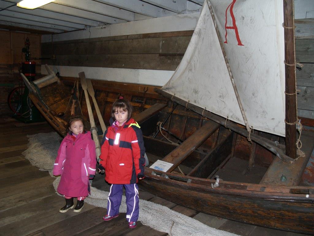
More than just a “fish guy,” Woody Knebel is an amateur archaeologist and has written a book on the Alutiiq petroglyphs in the area (“From the Old People, The Cape Alitak Petroglyphs”). To preserve local history, he also singlehandedly created a cannery museum on site which is full of wonderful old stuff from decades past, including an original wooden fishing dory with mast and sail.
After the tour Woody asked us, “Have you had lunch?”
Nope.
“Well, why don’t you join us in the Blue Room.”
Yes! We had made it to hallowed ground.
“The Blue Room” was a dining area from the main cafeteria for management only. Management being Woody and an elderly gent, also from Washington State, who was in charge of the machinery. We had lunch together and ate like pigs. They even offered us ice cream from the freezer behind them. Hearing those two magic words, “ice cream” Asmara’s and Adriana’s eyes lit right up. Sometimes it is so easy to make children happy.
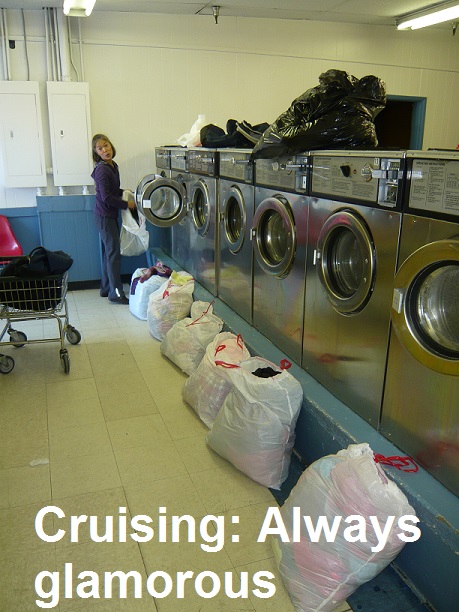
One of the hassles of living on a boat is doing laundry. In colder climes, like the one we were in now, it is truly astonishing how much clothing you go through in a week, especially if you have children on board. We live by layers and when something gets wet with sea water it will not dry again until washed in fresh. Naturally, the cannery had its own laundry facility and we were kindly allowed to do a few loads. What a treat: ice cream and laundry! It is amazing how the simple things acquire the most importance when you are living close to nature.
After piling our nicely dried and super clean laundry bags into the dinghy we said our goodbyes, went back to the boat, upped the anchor and headed out for our 5 pm date with destiny in the feared Olga Narrows.
Kangiyaq: Bay
As we approached the nefarious narrows the weather closed in and the cloud/fog ceiling once again dropped to about 100 feet. It was still a go and we powered up to the entrance. I made an announcement over the VHF radio:
“Securite, Securite, Securite. This is the 53 foot sailing vessel Asmara Sky. We are now entering Olga Narrows northbound. All concerned traffic standing by channel 16.”
This was to alert anyone else coming or going through here of our presence in case we needed to make room for each other. As we were in a pretty remote part of a pretty remote part of Alaska I didn’t expect to hear any response and there wasn’t any. All good. We ventured forth.
Despite it being slack water (the short period between the incoming flood tide and the outgoing ebb tide where there is no current) we saw our SOG (speed over the ground) range from 7.2 knots to 11.3 knots! The least depth we saw was 23 feet, well in excess of what we needed. The passage was a tense twenty minute ordeal with currents pushing the boat one way and then another as the water swirled and boiled around us. My beady little eyes were fixed intently on the chart plotter to make sure we kept in the deeper parts of the channel as Ariel tried to peer through the cloying fog with binoculars. Halfway through we heard a loud roar and as we came around a corner to our shock we saw a float plane heading right us at 100 knots 70 feet off the deck. Our mast is 75 feet.
He was following the narrows out through the fog, saw us and banked sharply. I jumped on the radio as he flew by and repeated my “Securite” call with the added, “…and we have a 75 foot mast!” Talking to a bush pilot later on in the summer I learned that they usually do not monitor VHF channels so he would not have known we were there. Oh well. You can’t plan for everything.
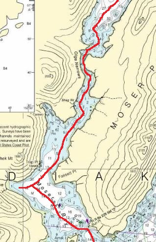
We squeaked through unscathed and anchored in the placid waters of Olga Bay in 30 feet at the appropriately named “Anchor Bay” (N 57 06.810 W 154 08.409). I let the hook drop to the sound of birds singing everywhere. We had made it.
Olga Bay is probably the only saltwater place in Alaska that has no tide to speak of. Alaska has some of the highest tides in the world with 33 feet of water moving in and out of the main city of Anchorage daily. On the east side of Kodiak Island the tides are only 10-12 feet in range, much the same as Seattle. Still one has to incorporate this relatively large change in depth when anchoring. It will do you no good and much harm to anchor in say, 12 feet of water at high tide, go to bed and wake up with the boat tipped over on its side in the mud as the tide rushes back in… On the west side of Kodiak which is exposed to the Shelikof Strait the tides are DOUBLE what they are just a few miles away with 22-25 foot tides a regular occurrence. When anchoring we always had to keep that foremost in mind.
TGS Asmara Sky spent a few days exploring Olga Bay which, aside from a few fish camps of set netters, we had to ourselves. It enjoyed a very pretty setting surrounded between gorgeous kelly green mountains which swoop down to form gentle lush valleys here and there. We saw lots of deer but no bears and everyday passed the time beachcombing as the girls continued to amass a huge pile of clam shells on board.
As always we tried our hand at jigging for fish. Asmara caught a 16 inch pollock, our largest yet which we let go, but even despite trolling from the dinghy we came up with squat. Maybe that pollock told his friends about us despite his “sore mouth”…!
With a short season and many more miles to go we left Olga Bay and passed through the narrows again hugging our original track, this time under ideal conditions with sunshine and birdsong cheering us the whole way. We timed our passage for 3 hours 40 minutes after Kodiak low tide and only saw 1.5 knots behind us. Spending the night in calm, tranquil and beautiful Sulua Bay just 33 miles away in 29 feet in slimy, stinky mud (N 57 01.077 W 153 51.286).
We continued our trek around the island by heading out around Cape Trinity at the bottom of the island and were immediately enveloped in thick, wet fog. A three to four knot tide set against us all the way through the eerie Geese Channel (pronounced “Geezey”). With fog surrounding us like a dripping futon the radar was on and it was the only way to find the navigation markers we needed to stay in the channel. It was pretty important to avoid rocks and shallow areas on both sides and watch for piles of kelp to avoid. Creeping along at 4 knots and fighting 3.5 knots of tide for what seemed a long time we finally got to the end of it and popped out the other side into sunshine again. Happy days.
That night we anchored in what my chart called “Jap Bay.” The chart plotter had a more politically correct “Japanese Bay” but “Jap Bay” is the local name. Apparently, it received this moniker because years ago the Japanese fishing fleet used to prowl these waters and they would often anchor in here.
Anchoring in 25 feet of water (now we were on the 10-12 foot tide side of the island) in a lagoon behind a spit of land we were in very protected water (N 56 58.126 W 153 41.084). The water was full of moon jellyfish expanding and contracting their way in swarms around the boat. They probably come in here to breed as it is calm and warm, I thought After showers and dinner we took the girls beachcombing to get even more clamshells. Asmara seems to have this idea she will be able to sell these things when we get back. I am not so certain but what is certain is they treat every shell collecting adventure as adventure and are as excited as children are during an Easter egg hunt. While they are bent over examining shells and the like I prowled the beach with a can of bear spray (Eau d’ours) and glass the area continually with my binoculars when I spotted something unusual.
Skuunaq: Sailboat
A sailboat. And coming this way into the bay, around the spit and into our lagoon. Wow, this was to be the first time we shared an anchorage with another sailboat so far this summer. “Ashanti-Ana” dropped the anchor near us 23 days out from Hawaii. Jap Bay was their first landfall. We dinghied over to chat with the couple on board who looked amazingly well for the long journey.
“How did you choose this place, Jap Bay?” I ask.
“Well, it was just on the rhumb line,” was their answer, meaning it was just in the way.
We left quietly at dawn the next day and clearly the crew on “Ashanti-Ana” were enjoying a well-deserved uninterrupted sleep after their 2,000 mile trip up from Honolulu. An hour out as the sun rose higher in the clear morning sky a lone humpback whale began his show in the glassy calm water. Just past Two Headed Island in Sitkalidak Strait a few hundred yards ahead of us he lunged up out of the calm sea lifting his bulk 2/3 out of the water. He spun in a ¾ turn in what seemed slow motion for such a large animal and came crashing back down into the water with a tremendous splash. We watched enthralled at his incredible display of power and perhaps just sheer happiness at being alive as he lungd up, turned gracefully and fell back into the sea over and over again.
Motorsailing 46 miles took us to Shearwater Bay where we anchored in 25 feet (N 57 20.811 W 1532 53.124). It was another amphitheater setting of natural beauty which we, again, had all to ourselves.
Late afternoon on the next day we pulled into St. Paul Harbor in Kodiak town and completed our 12-day, 461 mile circumnavigation of the island. So far this summer we had cruised 1,986 miles and still were heading north. We spent a day doing laundry, provisioning and fueling up for the next leg of the trip which will take us across the feared Shelikoff Strait to the wild Katmai area of the Alaska Peninsula where there are no towns and the hungry bears roam free.